LAKES AND HIGH PASSES OF VANOISE self-guided

6 days at the heart of France's first National Park
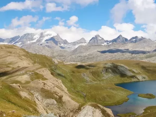
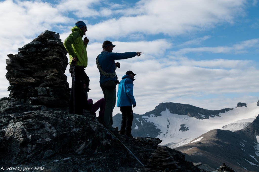
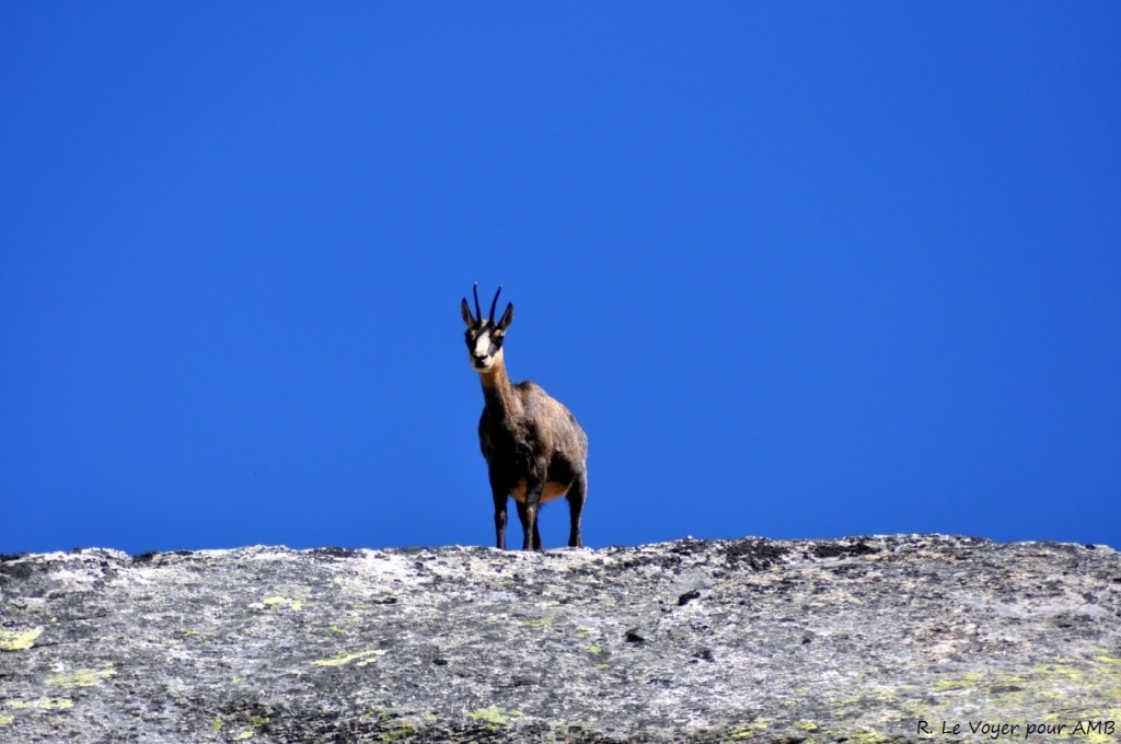
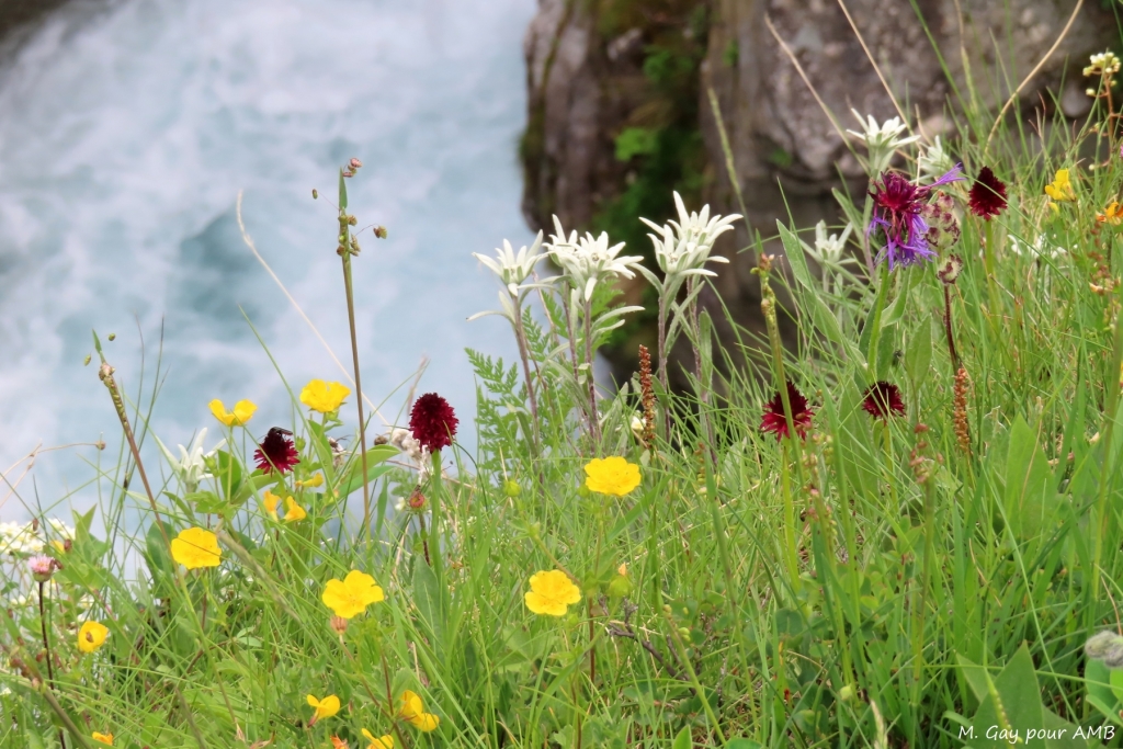
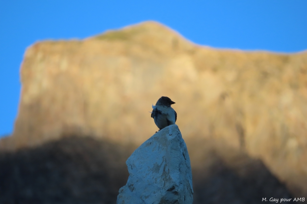
First of its kind in France, Vanoise National Park was established in 1963. A vast territory where flora, fauna and rocky mineral world are all preserved. Between Maurienne and Tarentaise valleys, its borders meet Gran Paradiso massif in Italy, forming the largest nature reserve in Europe. At the centre of this mountain range lays the icecap of Domes de la Vanoise, extending over twenty kilometres.
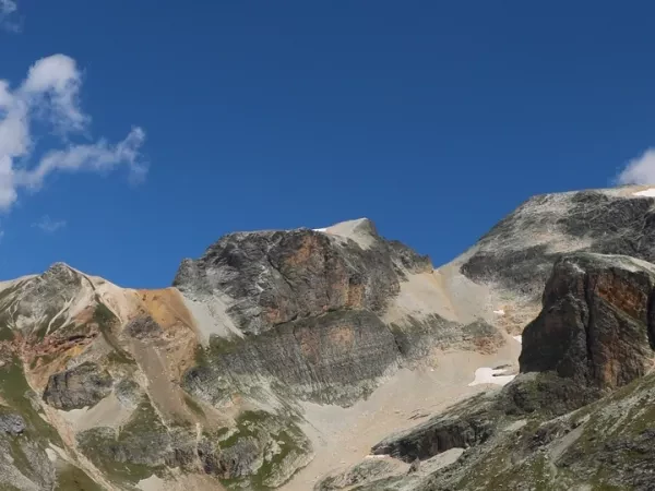
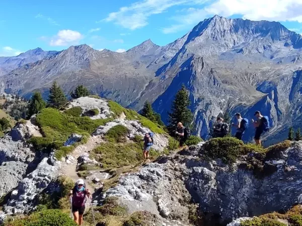
This journey, at the heart of the park, takes a path via high mountain passes which connects Aussois, Pralognan and Haute Maurienne. Trails at high altitude in a fragile mineral world, the vast mountain pastures of Vanoise and the dry-stone buildings punctuate this beautiful journey.
First of its kind in France, Vanoise National Park was established in 1963. A vast territory where flora, fauna and rocky mineral world are all preserved. Between Maurienne and Tarentaise valleys, its...
First of its kind in France, Vanoise National Park was established in 1963. A vast territory where flora, fauna and rocky mineral world are all preserved. Between Maurienne and Tarentaise valleys, its borders meet Gran Paradiso massif in Italy, forming the largest nature reserve in Europe. At the centre of this mountain range lays the icecap of Domes de la Vanoise, extending over twenty kilometres.
This journey, at the heart of the park, takes a path via high mountain passes which connects Aussois, Pralognan and Haute Maurienne. Trails at high altitude in a fragile mineral world, the vast mountain pastures of Vanoise and the dry-stone buildings punctuate this beautiful journey.
You will love
- The wild and protected area of the first National Park in France
- A route over high mountain passes along glacier of Dômes de la Vanoise
- A great variety of landscapes between Maurienne and Tarentaise
- Stages at Pralognan and Bonneval-sur-arc villages
- Accommodation in gites, refuges and small friendly hotels
LAKES AND HIGH PASSES OF VANOISE self-guided
Level 3 / 4
Secure payment

Day-by-day itinerary
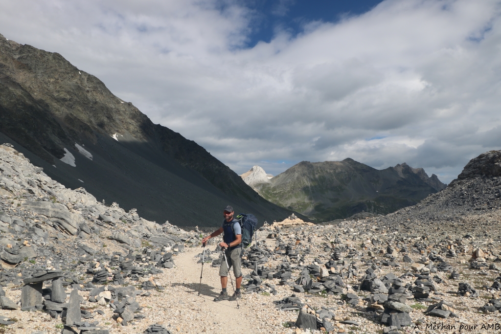
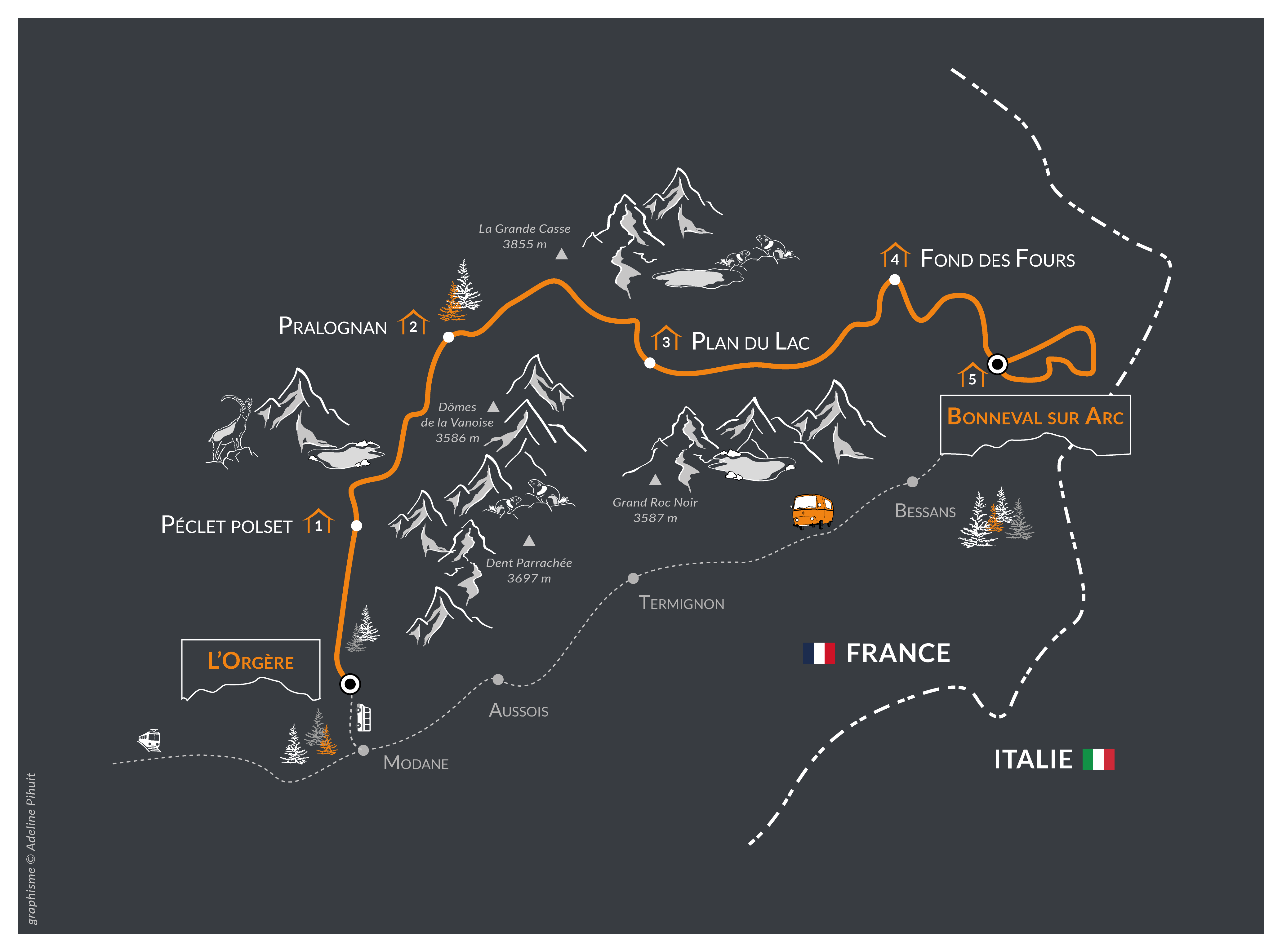
Departure of the hike at Orgere refuge.
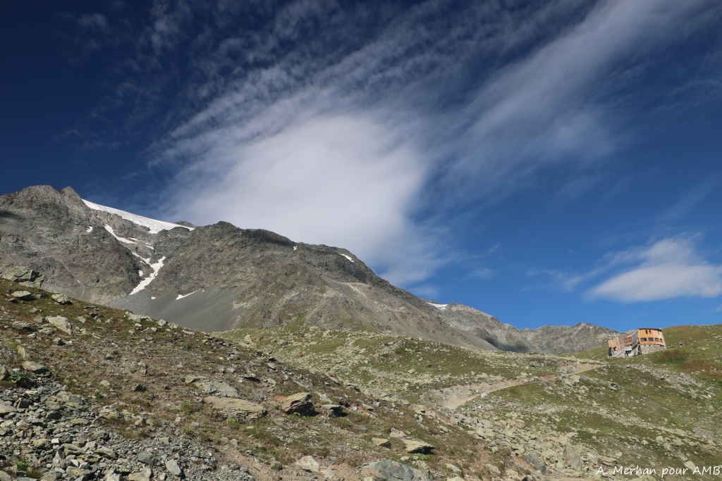
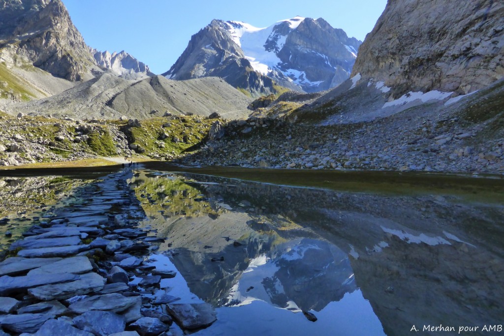
REFUGE DE L'ORGÈRE - CHAVIERE PASS - PECLET-POLSET REFUGE
From Orgere refuge, ascent to the Chaviere pass, entrance to the heart of the Vanoise National parc. The path goes across green pastures and rocky landscapes to the gorgeous refuge of Peclet Polset. Night in refuge.
4.30 hour walk / Elevation: +950m ; -400m / 9km
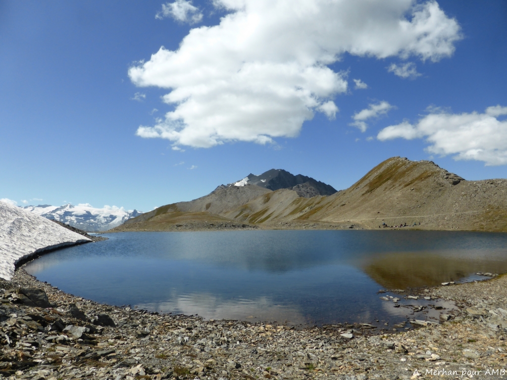
SOUFFRE PASS - PRALOGNAN LA VANOISE
From the refuge, the path goes near the sumptuous "Lac Blanc" before rising towards the Souffre pass behind which is the large Gibroullaz glacier. Descent by the same path before going along the large valley of Chavière to reach Pralognan la Vanoise, capital of hiking. Possibility to shorten the stage from Les Prioux, with a bus or a taxi. Night in hotel / gite.
7 hour walk / Elevation: +500m ; -1550m / 18km
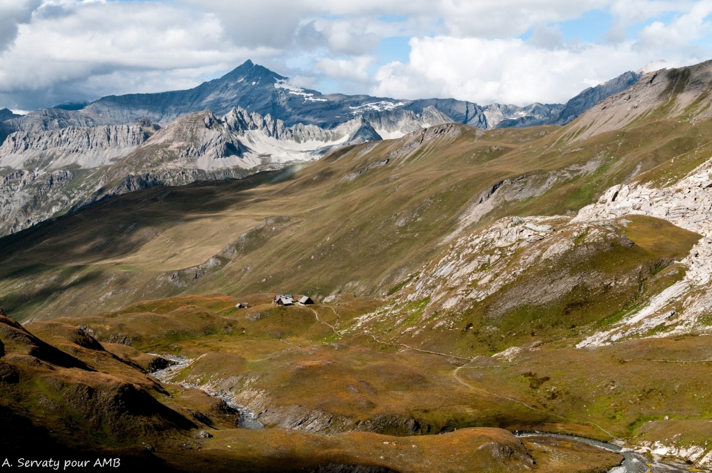
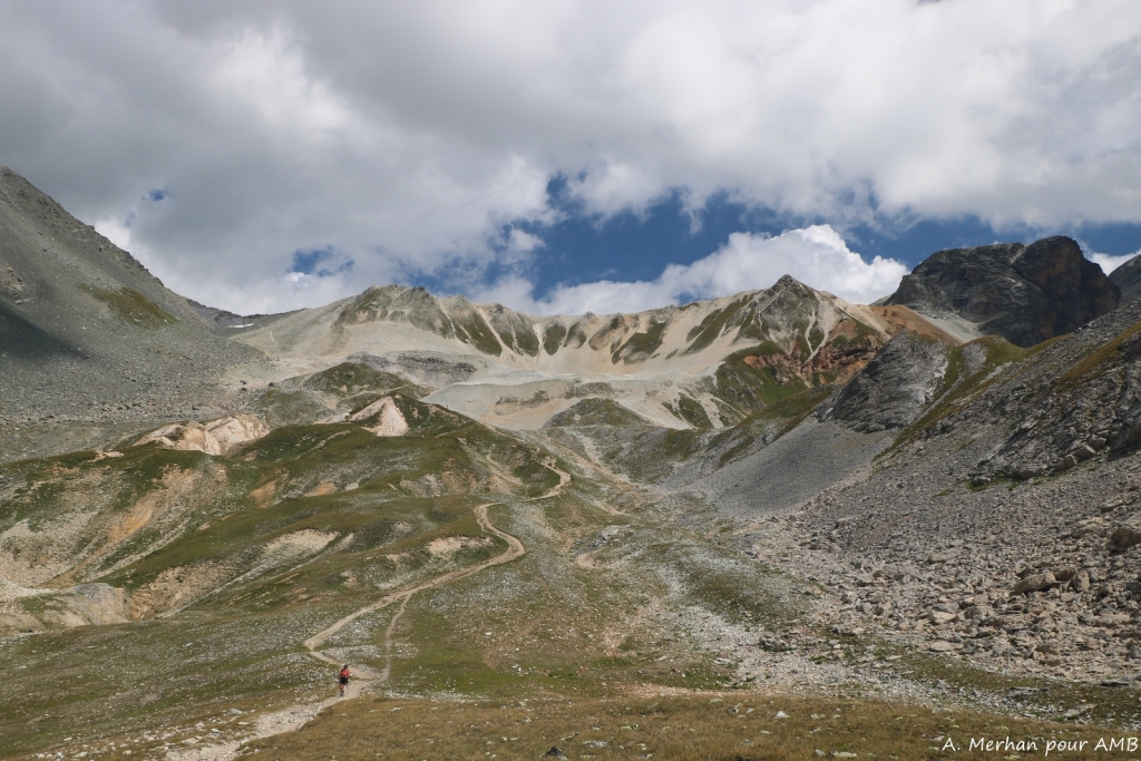
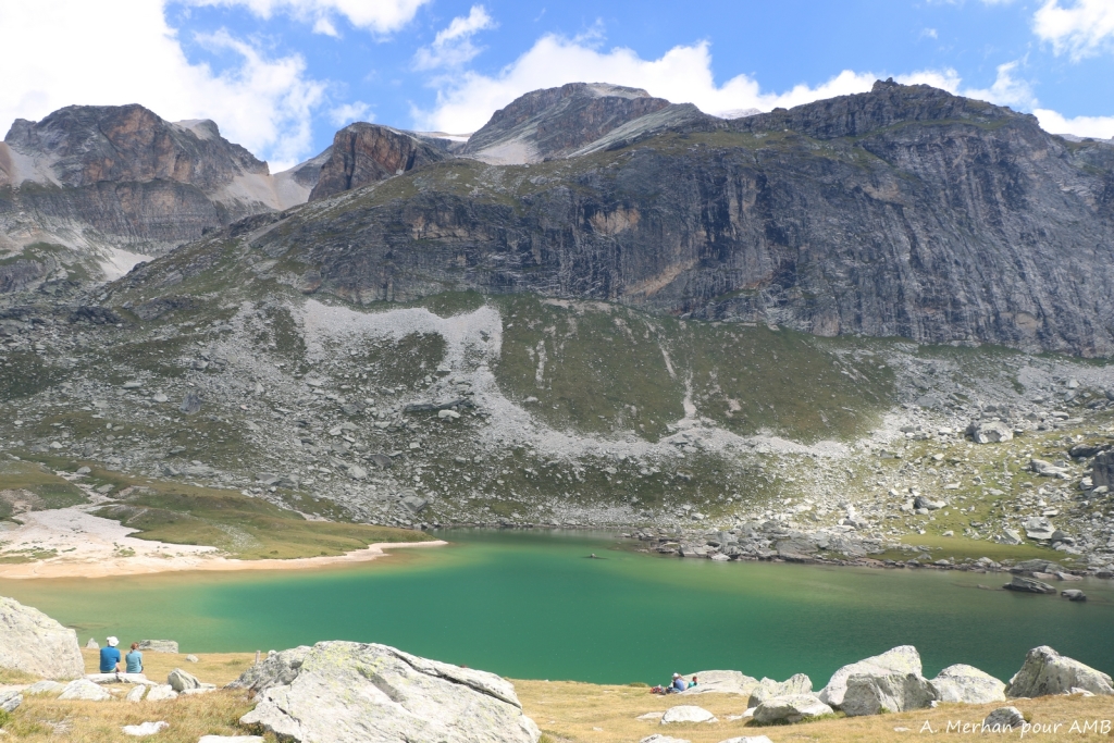
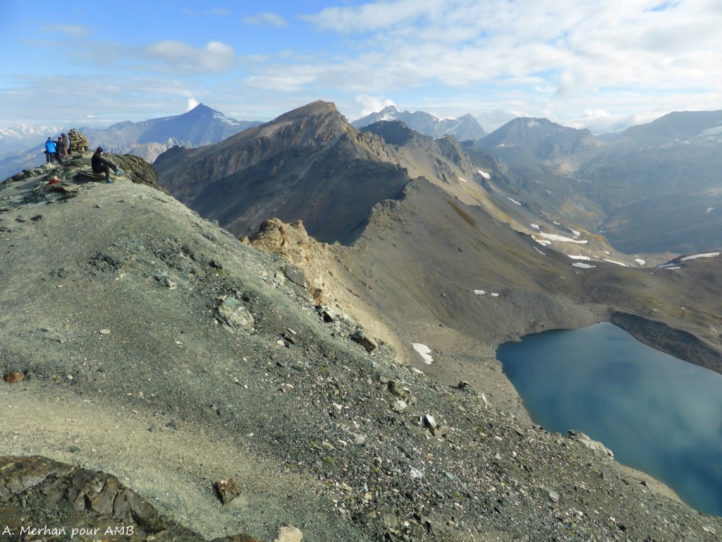
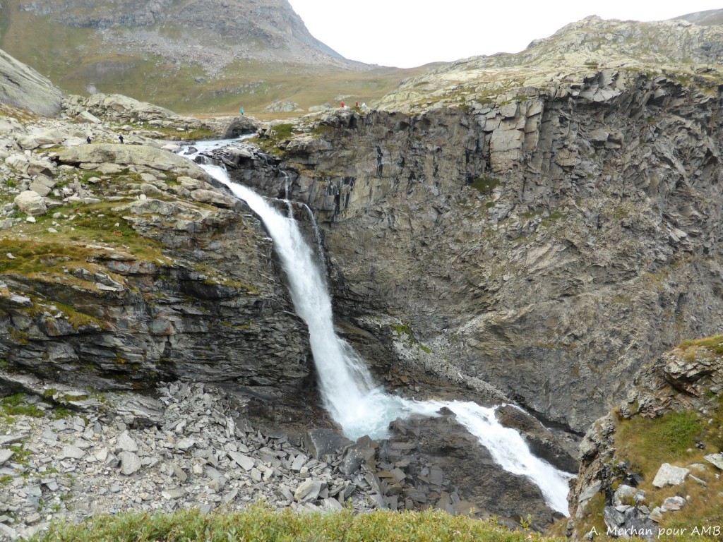
VANOISE PASS - PLAN DU LAC REFUGE
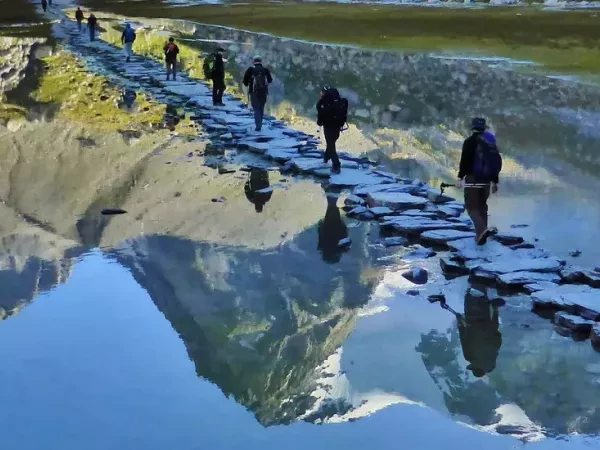
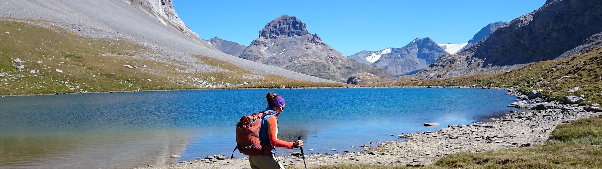
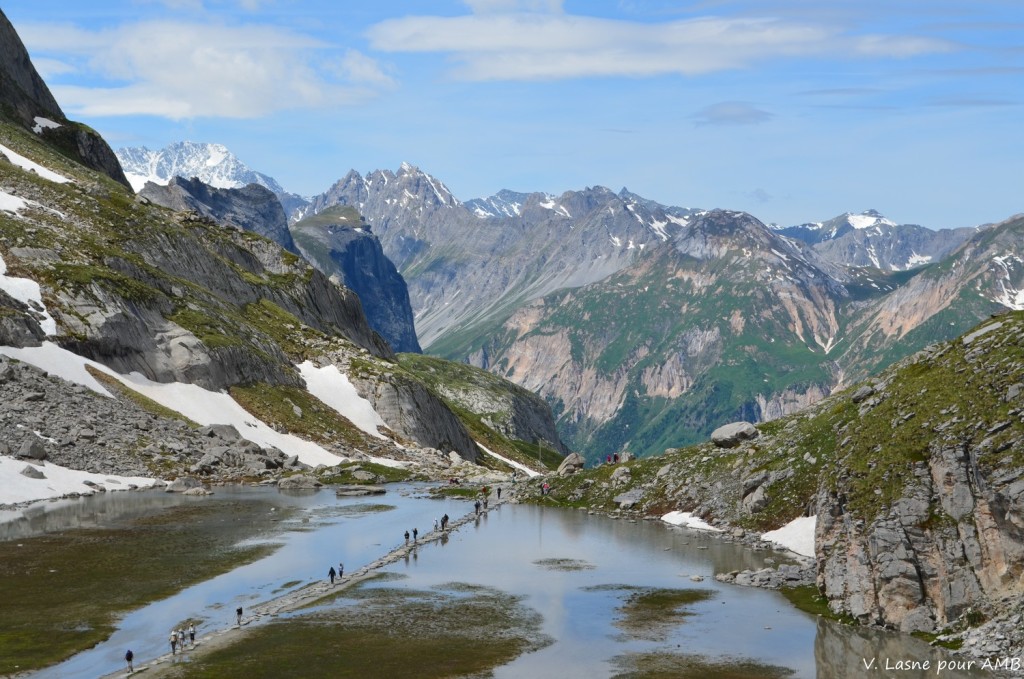
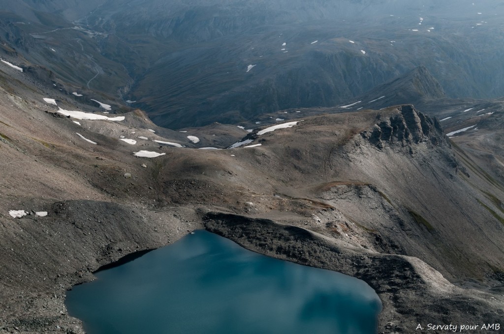
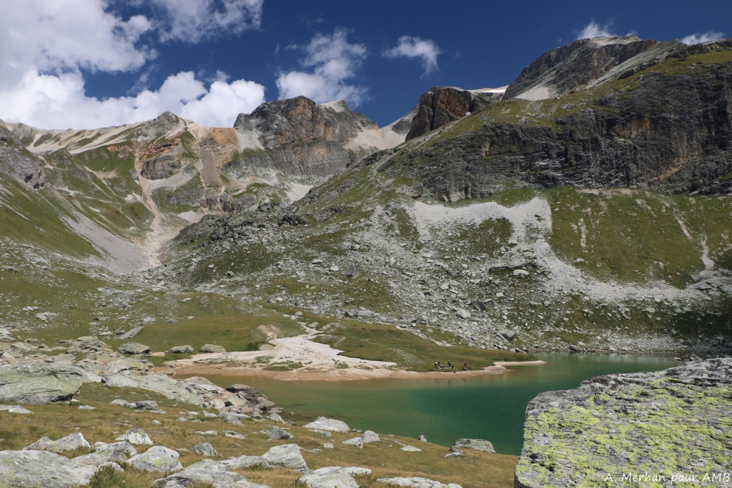
Short transfer possible to "Les Fontanettes". Climb to Vanoise pass (2517m). Amazing view over the "Aiguille de la Vanoise" and the "Grande Casse" (3855m), highest point of the mountain range. Going to "Lac des Vaches" and its famous ford, and then Long lake and Rond lake. Arriving in Leisse valley and Plan du Lac refuge. View over the "Dômes de la Vanoise". Night in refuge.
7.5 hour walk / Elevation: +1550m -570m / 18km
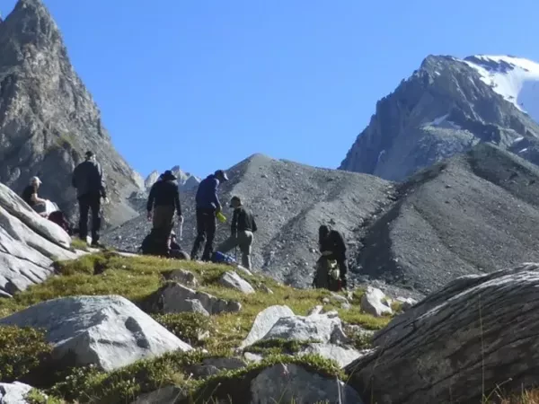
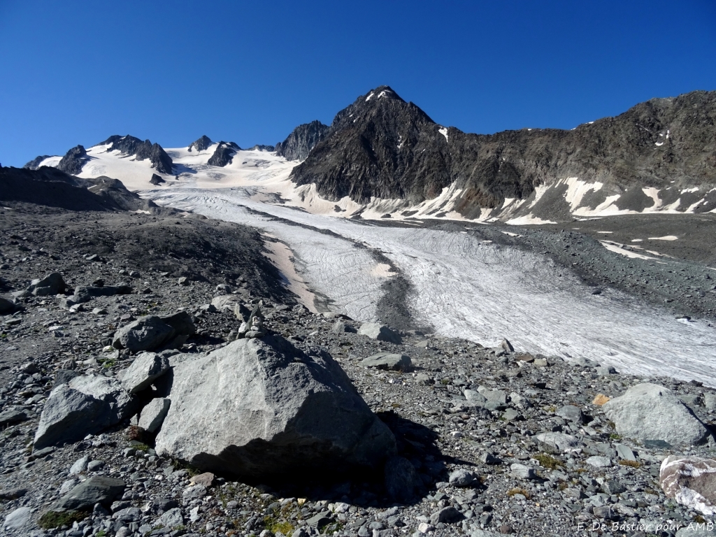
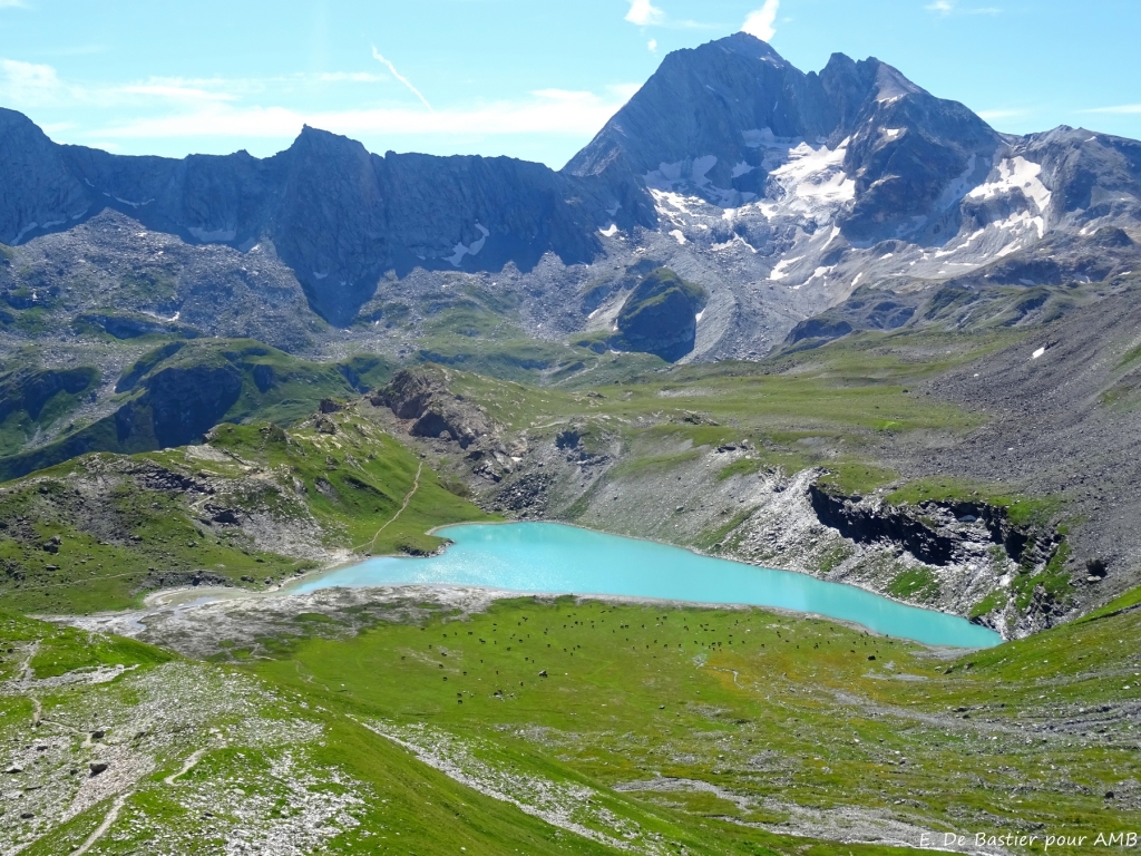
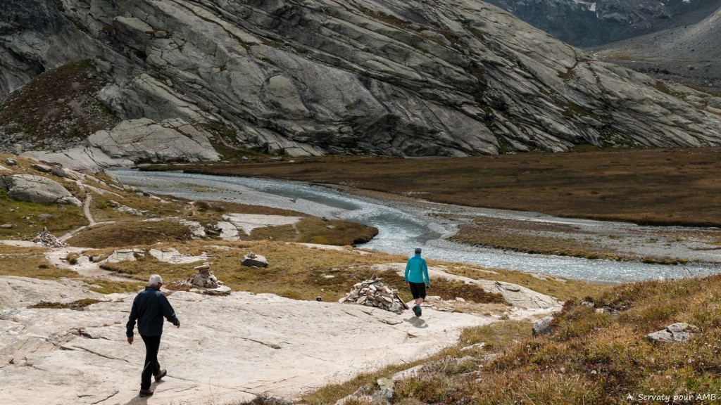
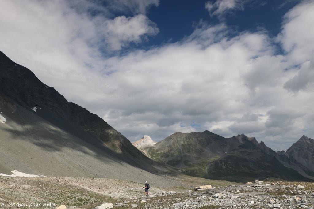
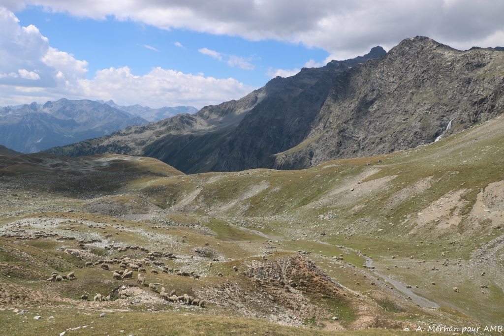
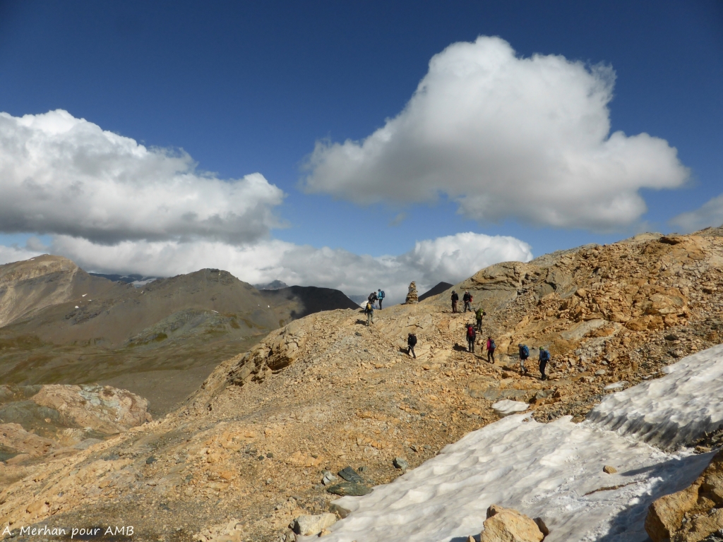
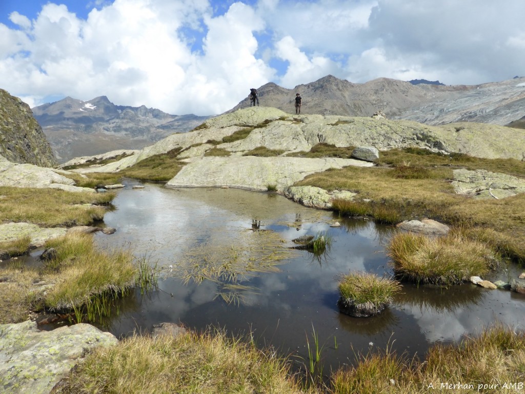
ROCHEURE LAKE - FOND DES FOURS REFUGE
Departure towards Rocheure valley, climb up to the lake and to the mountain pass at 2900m high. Cross the desert and wild Méan Martin high glacial plateau to reach Fond des Fours refuge, at the the foot of the north face.
7 hour walk / Elevation: +950 m ; -780 m / 18km
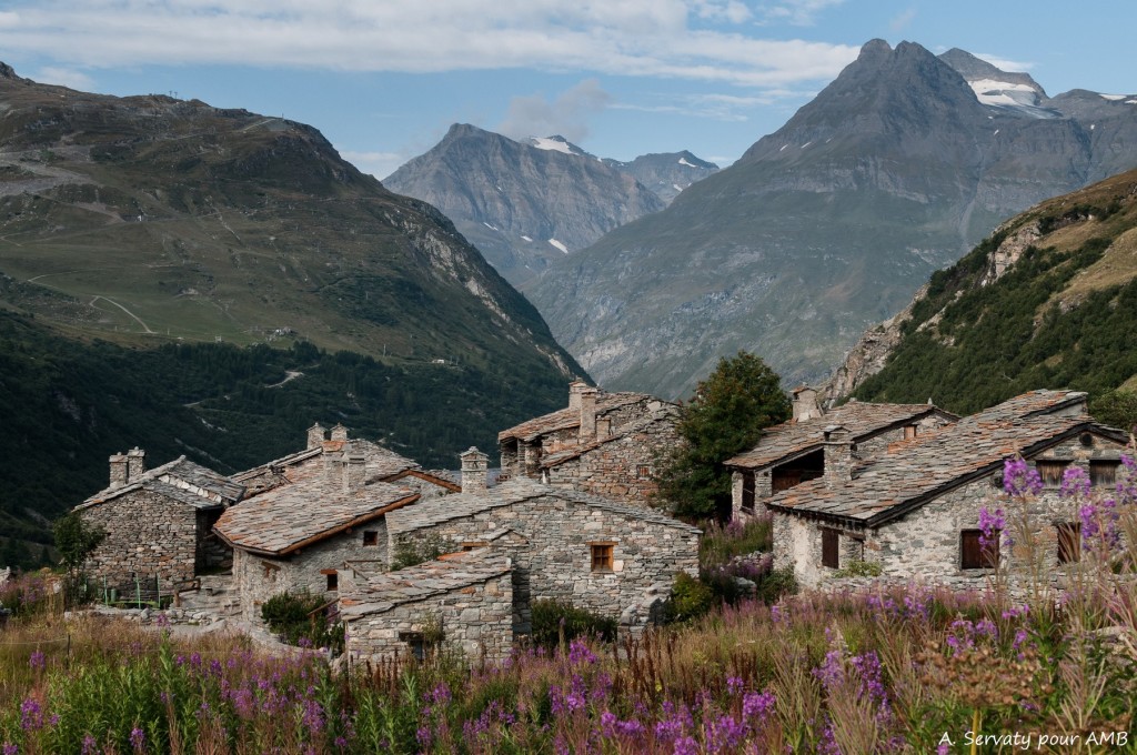
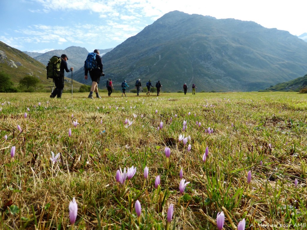
COL DES FOURS - BONNEVAL SUR ARC
Climb to Col des Fours (2976m), then descend to Pont de la Neige below Iseran mountain pass. Cross mountain pastures to arrive at the very pretty Bonneval-sur-Arc village. Option to shorten the stage by walking directly to the village (10km, +450m-1150m, 4.30 walk). Night in a gite.
6.5 hour walk / Elevation: +780 m ; -1500 m / 15km
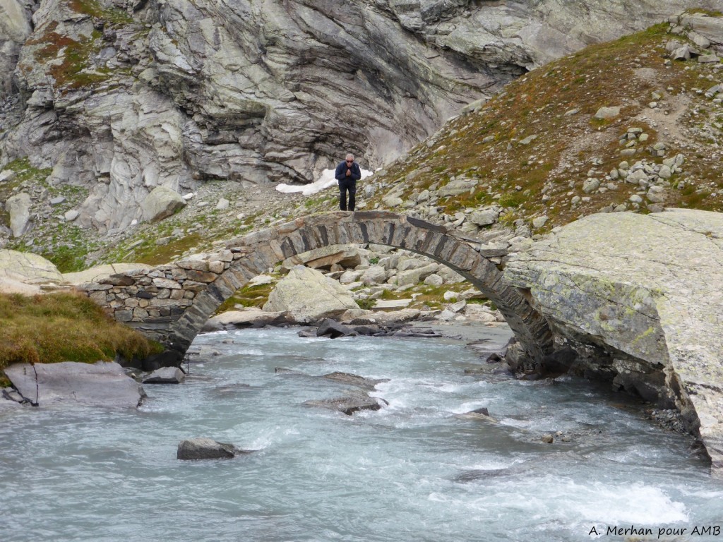
L'ÉCOT - EVETTES VALLEY
Last day in the upper Arc valley. Climb up the Vallon des Evettes to the refuge, passing through the pretty village of l'Ecot (listed village) and, conditions permitting, through the gorges of La Reculaz.
6 hour walk / Elevation: +/- 820m /14km
End of the tour around 15:30 and bus transfer.
The itinerary is established according to the latest information available, unknown factors and situations beyond our control can affect this itinerary and may change the route, timings etc.
Dates and prices
DEPARTURE AND PRICES
Departure from June 21 to September 06, 2026
Without luggage transfer :
650€ per person, classic accommodation
Single departure : 90€
With luggage transfer (on nights 2, 3 and 5) departure on monday, tuesday, thuesday, friday and sunday :
2 - 3 persons : 855 € / person
4 - 5 persons : 825 € / person
6 persons : 790 € / person
Picnic option x5 (Day 2 to Day 6): €75 per person
Book online
Secure payment
THE PRICE
Includes:
- Accommodation with half board and tourist tax;
- 1 road book file (paper) for a group of 1 to 4 people and the digital version to download for each participant; additional paper road book on request ;
- Organisation and booking fees.
Does not include:
- Lunch picnic ;
- Shower tokens ;
- Guiding : your are responsible for your own safety ;
- Personal expenses (drinks, visits, etc.) ;
- Travel insurance ;
- Your return journey from home to the point of departure/end point.
The price is all inclusive from departure to end point.
Technical sheet
LEVEL ***
Elevation: +/- 900m approximately per day.
Walking time: 5 to 7 hours per day.
Type of trek: mountain hike on marked trails including gravel paths.
You need to be in a good overall physical condition. Regularly practise an endurance sport such as walking, running, swimming or cycling, 3 to 4 hours a week. Your fitness training will make your walk easier and make it all the more enjoyable. Click here for a description of the different levels: levels of difficulty
Le roadbook fournit les informations nécessaires pour effectuer votre randonnée.. Il reste cependant indispensable de savoir maîtriser la lecture de carte au 1:25'000 et d'être suffisamment autonome en montagne pour pouvoir aborder l'itinéraire sereinement, quelle que soit la météo (brouillard, neige,...). L'encadrement par un professionnel n'est pas inclus dans le forfait liberté.
Vous risquez de traverser des zones blanches, sans réseau téléphonique. Pour votre sécurité, vous pouvez vous munir d'une radio ou d'un téléphone de dernière génération permettant de communiquer via un satellite.
Please note: some névés will be present on the paths until the end of June, particularly on the North slopes. High mountain boots, gaiters and walking poles are essential. Be prepared!
ROAD BOOK
One month prior to departure, we will send you your travel documents. We offer two roadbook versions:
The "paper" version we send by post:
- 2 IGN TOP 25 maps with the route
- 1 road-book with all the necessary information for the hike
- 1 map holder
- The list of accommodation
The "digital" version is an application to download on your smartphone, accessible to each of the participants of the file. The information for downloading and using it is sent by e-mail.
ACCOMMODATION
CLASSIC: 3 nights in dormitory, in refuge ; 2 nights in a room of 2/3 poeple in hotel or gite.
Accommodation offer hot showers except Fond des Fours refuge. However, due to increasingly recurrent periods of drought, access to showers is not guaranteed.
LUGGAGE TRANSFER
There are 2 options:
Without luggage transfer: you carry all your luggage.
With luggage transfer: your luggage is delivered to your accommodation on days 2, 3 and 5.
MEALS
Breakfasts and dinners are provided in each accommodation. Picnics are not included and can be pre-ordered in each accommodation in the evening (except day 1). Possibility to buy picnic supplies in small local shops.
Please inform us about your food allergies and special diets at the time of booking. We do our best to accommodate special diets (gluten-free, vegetarian, etc.). However, we encourage you to bring some additional products for your own picnics.
MAPS
IGN maps 1:25000 : Tignes-Val d'Isère 3633ET, Les Trois Vallées 3534OT.
ACCESS TO DEPARTURE POINT
Departure of the hike from the refuge-Porte de l'Orgère.
BY TRAIN
Arrival at Modane train station and then bus or taxi transfer to Orgère. Timetables must be checked on the SNCF website.
BY CAR
Take the A6 motorway to Lyon, then the A43 direction Chambery and Modane. At Modane follow Aussois direction via the D215. Free parking next to the tourist office.
CAR-SHARING
Get in touch with people to share a lift ! https://www.blablacar.fr/ https://www.laroueverte.com/ https://www.roulezmalin.com/
At the end of the tour, bus transfer to Aussois or Modane arriving at 15:30.
ACCOMMODATION BEFORE AND AFTER
Tourist Office Aussois: +33 (0)4 79 20 30 80 www.aussois.com
TO CONTACT US
If you are late please contact the agency as soon as possible on: +33 (0)4 50 79 09 16 or +33 (0)6 42 49 76 07
EQUIPMENT LIST
Clothing
- Walking trousers
- Shorts (Bikini/swimsuit, just in case!)
- Breathable or merino wool t-shirts
- Breathable or merino wool leggings
- Fleece or jumper
- Wind stopper or Goretex jacket
- Lightweight down jacket
- Waterproof poncho + gaiters or Goretex trousers + waterproof rucksack cover
- Pair of gloves and a warm hat
- Sun hat or baseball cap
- Walking socks (1 pair per day)
- Sturdy walking boots with a good sole, already broken in
- 1 change of clothes for the evening
- A pair of comfortable shoes for the evening
Other Equipment
- Toilet bag
- Quick drying towel
- Sunglasses and sun cream
- Water bottle or Camelback (1.5 litre minimum)
- Knife, fork and spoon
- Plastic lunch box/plate for your picnic lunches (0,4 ~ 0,5L)
- Plastic cup for coffee
- Small First Aid kit (antihistamine, ibuprofen, Compeed type blister pads...)
- Survival blanket
- Head torch or hand torch
- Sleeping bag liner sheet and pillowcase (blankets provided at accommodation)
- Two adjustable walking poles (highly recommended)
- Identity card or passport
BACKPACK
Bring a comfortable backpack of 40 to 50 litres for your personal belongings for the day (warm clothes, waterproofs, water, plate and cutlery for your picnic, sunscreen and your identity papers) and please keep a little room to carry a picnic and snacks.
LEAVE ON YOUR OWN FOR 2 OR 3 DAYS AND MORE
In the 'weight is the enemy' section, here are some tips on how to save a few hundred grams. For example, for your toiletries: a simple plastic bag with a zip or a small plastic box to avoid accidental crushing.
- Hotel-size soap is generally enough for a week.
- A tube of toothpaste 3/4 full will do the trick
- Shaving foam: a small sample can
- A small microfibre towel
- A small bottle of shampoo
- A travel toothbrush
Pharmacy: in addition to your personal medicines, bring:
- Elastoplast or hook-and-loop tape
- "Second skin" tape to protect against blisters, such as Compeed
- A small pair of scissors, thread and needle
- A small tube of sun cream and lip balm
Now all you have to do is apply this recipe to your entire bag!