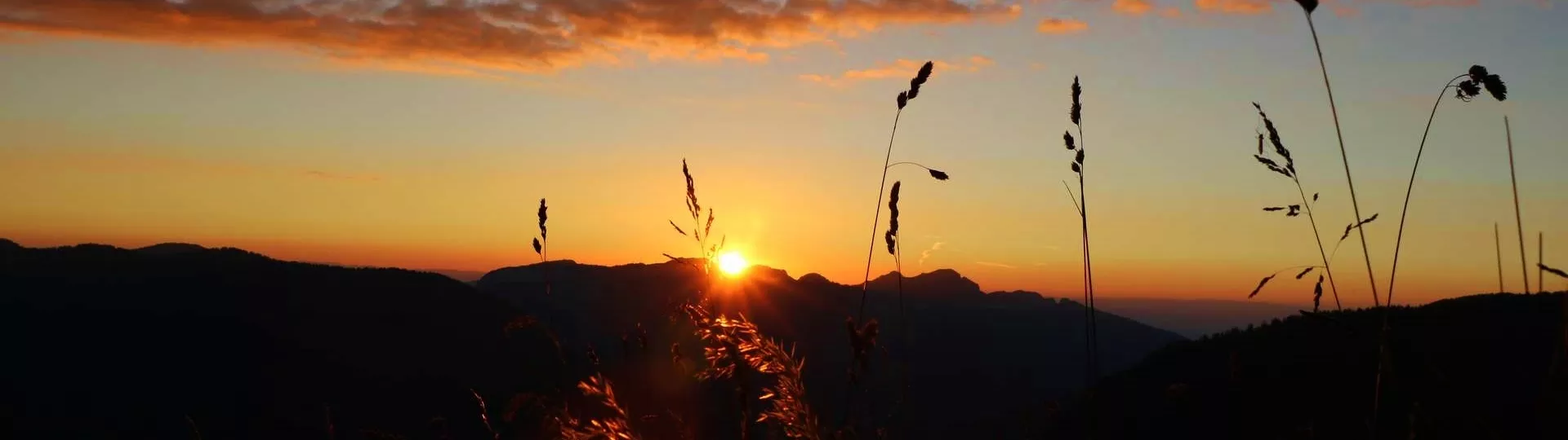
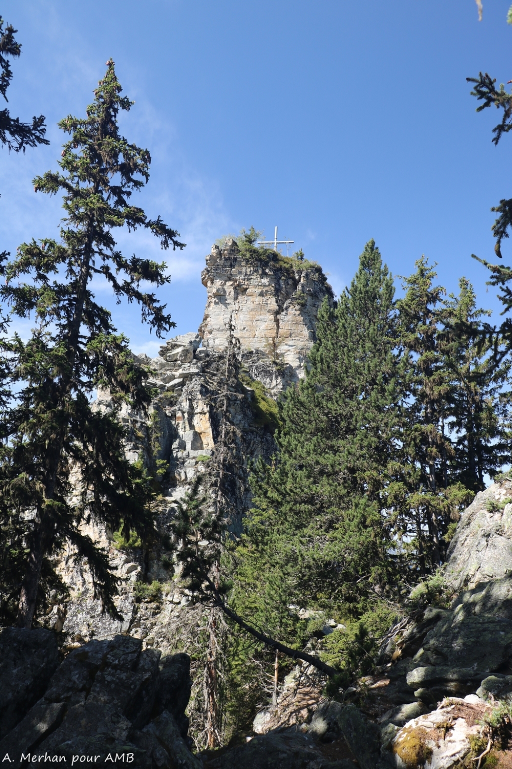
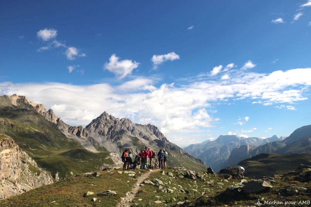
From Lake Geneva to Menton
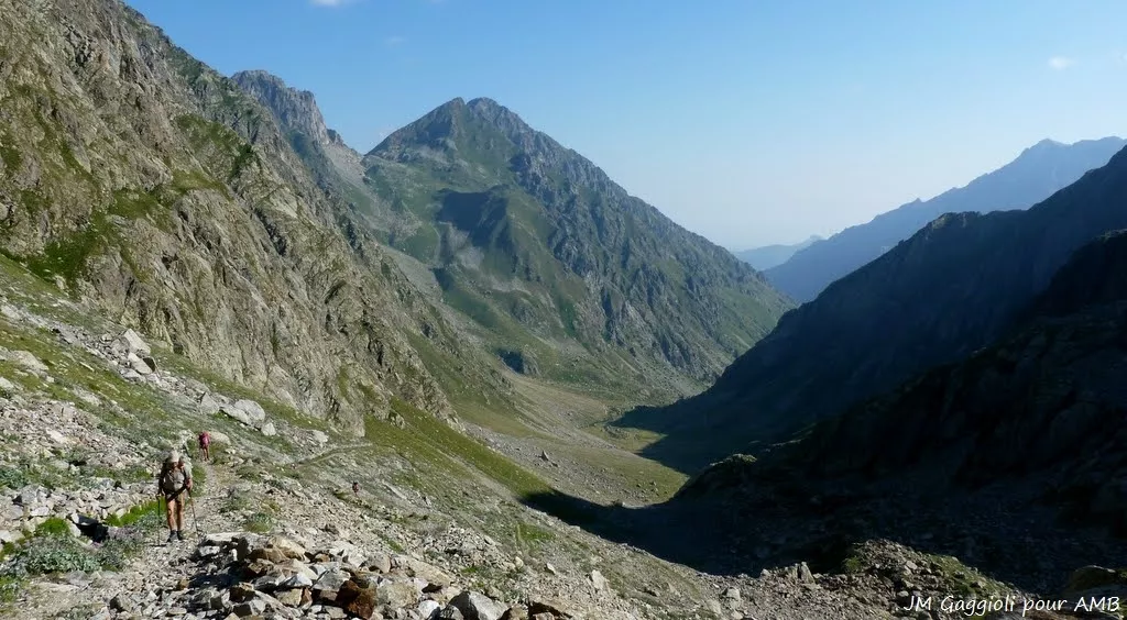
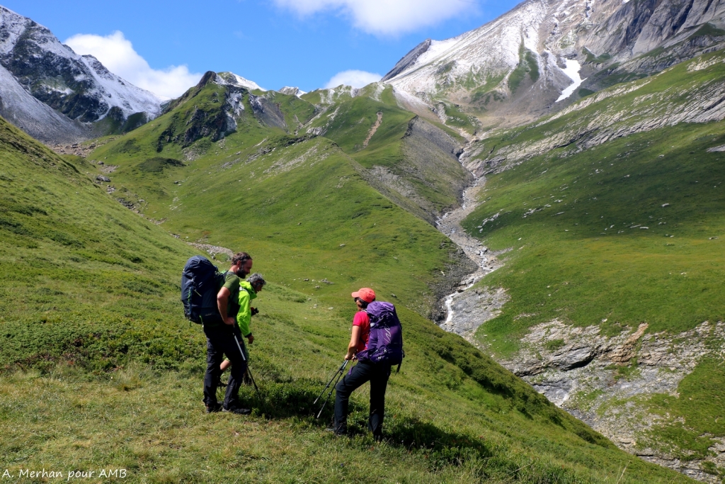
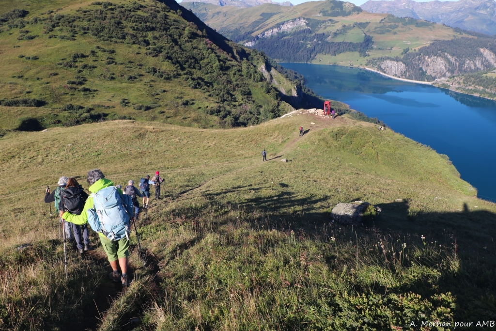
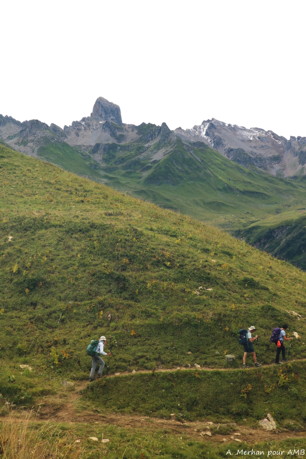
Travel across the Alps, meeting both the people and the mountains. The Grande Traversée des Alpes (GTA) between Lake Geneva and the Mediterranean is a long-distance hike. The opportunity to take a long break and put daily life aside. This itinerary runs along the Swiss and Italian borders while crossing five counties and some of the most famous mountain ranges in the Alps.
Travel across the Alps, meeting both the people and the mountains. The Grande Traversée des Alpes (GTA) between Lake Geneva and the Mediterranean is a long-distance hike. The opportunity to take a lon...
Travel across the Alps, meeting both the people and the mountains. The Grande Traversée des Alpes (GTA) between Lake Geneva and the Mediterranean is a long-distance hike. The opportunity to take a long break and put daily life aside. This itinerary runs along the Swiss and Italian borders while crossing five counties and some of the most famous mountain ranges in the Alps.
You will love
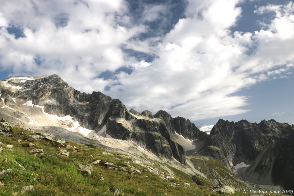
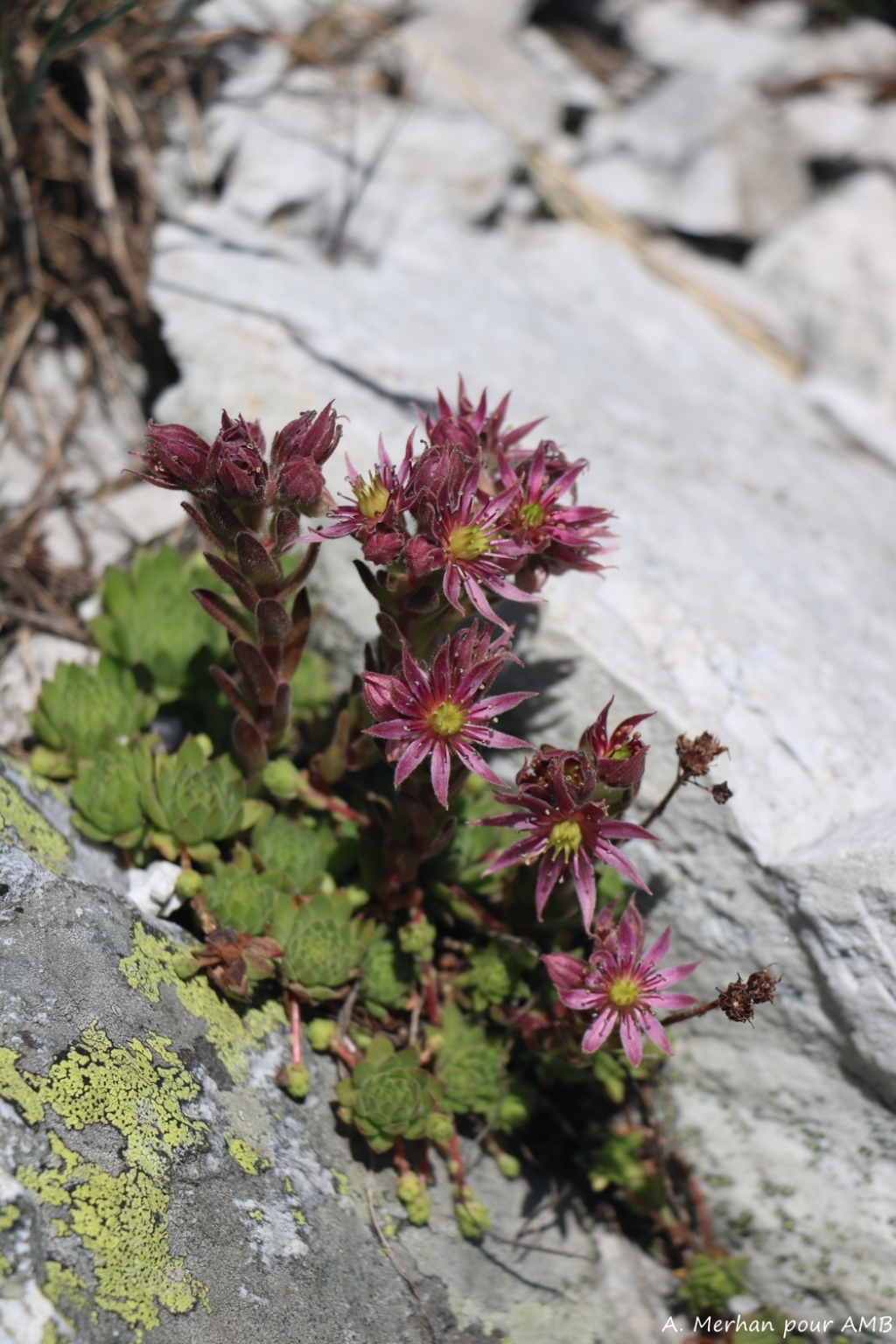
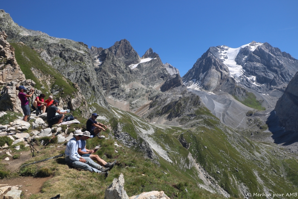
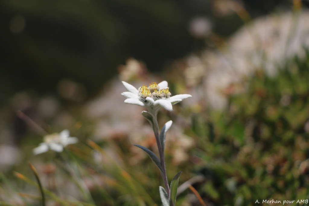
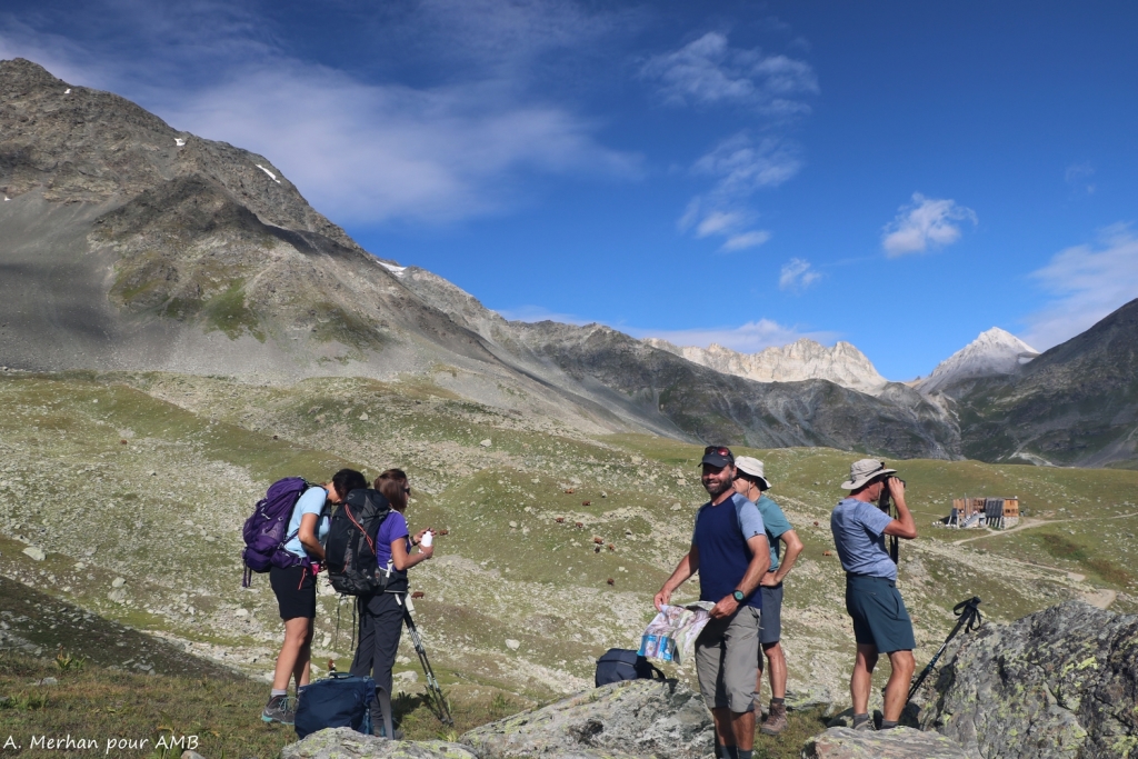
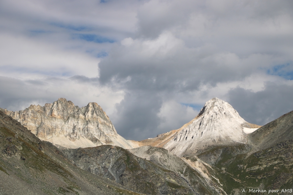
- Crossing mountain ranges with varied geology and landscapes
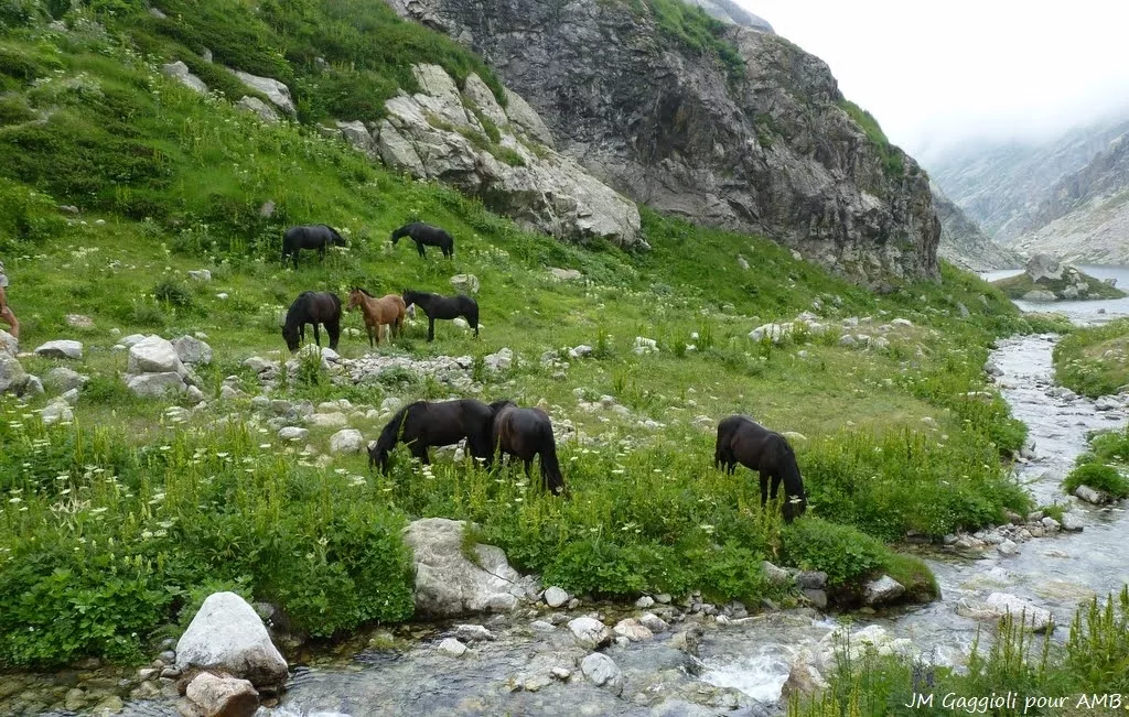
- Rich ecosystems, abundant wildlife and valleys full of history
- Luggage transfer
GRANDE TRAVERSEE DES ALPES - sections 1, 2, 3 and 4
Level 3 / 4
Next departure on 28/06/2026
Secure payment

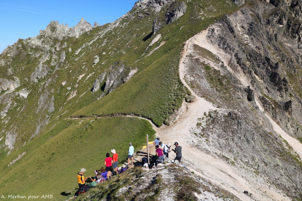
Day-by-day itinerary
Meet at 12:30pm in front of the Tourist Office in Thollon-les-Mémises or at 9:30am infront of Chamonix train station if you have chosen this option. A picnic lunch will be taken at the start of the walk.
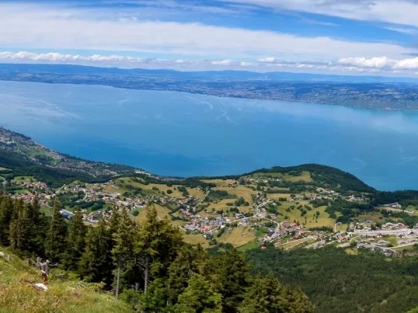
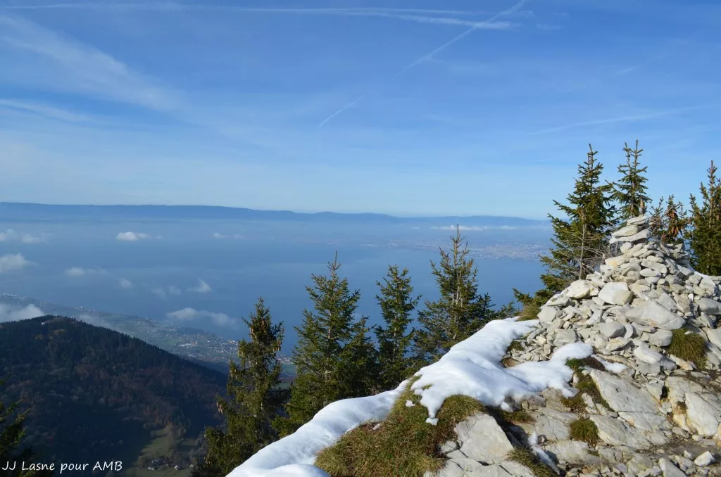
PIC DES MEMISES - BALCON DU LEMAN
Take the cablecar and depart towards the balcony trail overlooking Lake Geneva. Picnic lunch and then cross the Mémises and the alpine pastures of Mottay before descending to the Novel valley. Night in a refuge in the pastures without luggage transfer.
3.5 hours walk / Elevation : + 500 m ; - 550 m / Distance : 8 km
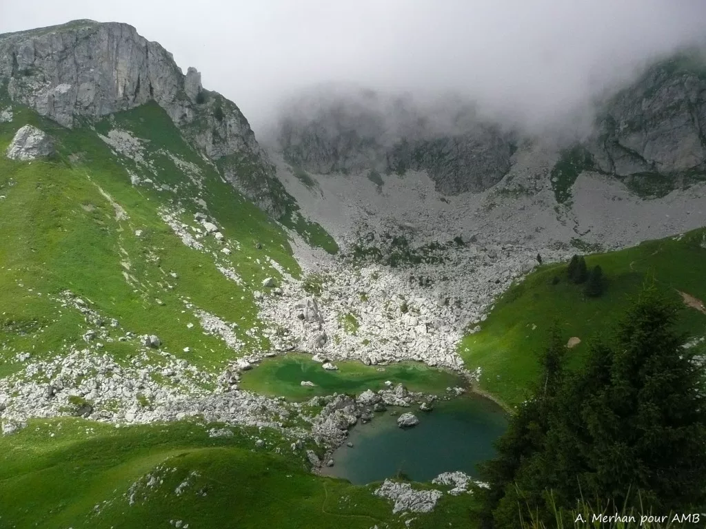
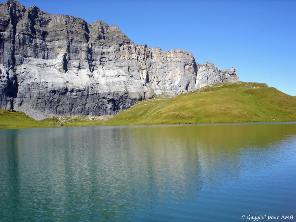
BISE PASS - BISE VALLEY
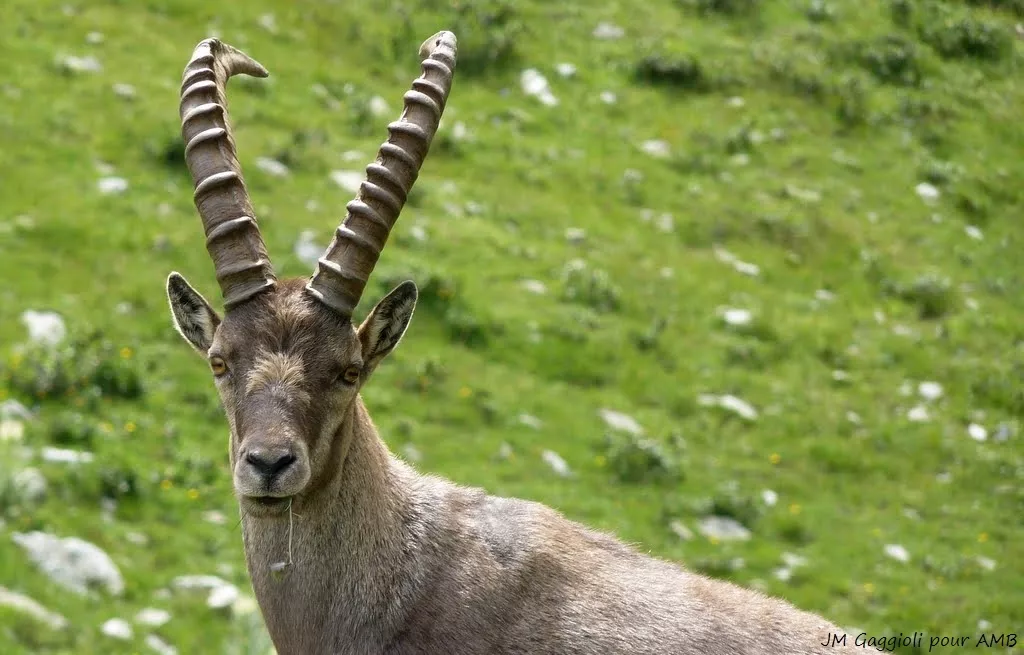
From the refuge, climb to Lake Neuteu and the Bise pass. Short detour possible to the beautiful glacial Lake Darbon under the watchful eyes of the ibex! After having crossed the "Pas de la Bosse", long descent to reach Chapelle-d'Abondance. Nigth in an Auberge in the typical village of La Chapelle-d'Abondance.
6 hours walk / Elevation : + 900 m ; - 1400 m / Distance : 12 km
ABONDANCE - LAKE TAVANEUSE - LAC DE MONTRIOND
Short transfer. Climb to Lake Tavaneuse and to the mountain pass at 1997m. Descend through the pastures and the forest to Lake Montriond. Transfer to the Chardonnière refuge. Night in a dormitory.
7 hours walk / Elevation : + 950 m ; - 1600 m / Distance : 13 km
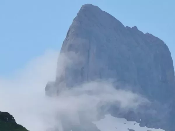
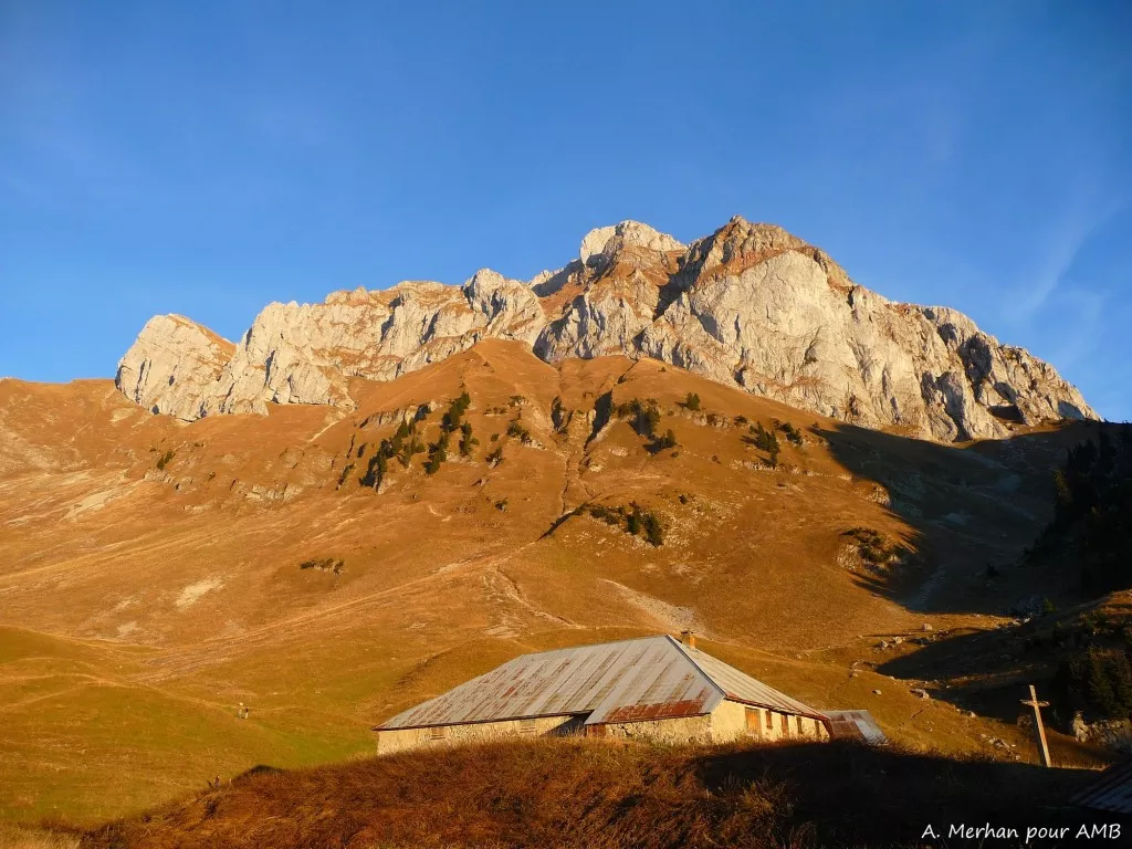
DENTS BLANCHES MASSIF - PAS AU TAUREAU
Climb to the Tête de Bostan facing the superb and wild Dents Blanches massif. Cross the 'Pas au Taureau' (2555m) via a short cabled passage, then descend into the lunar-like valley of the Combe aux Puaires, an unusual area of lappiaz (eroded limestones). Night at the Vogealle refuge in a dormitory without luggage transfer.
7 hours walk / Elevation : + 1300 m ; - 750 m / Distance : 11 km
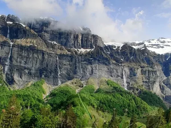
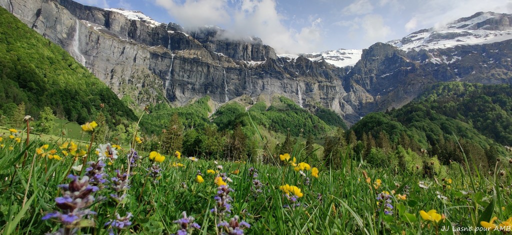
BOUT DU MONDE AND CIRQUE DU FER À CHEVAL
From the Vogealle refuge, a beautiful descent facing the Tenneverge cliffs and on to Bout du Monde, continuing to the amphitheatre at Sixt-Fer-à-Cheval and its multiple waterfalls. Night in the village of Sixt-Fer-à-Cheval.
6 hours walk / Elevation : + 200 m ; - 1250 m / Distance : 17 km
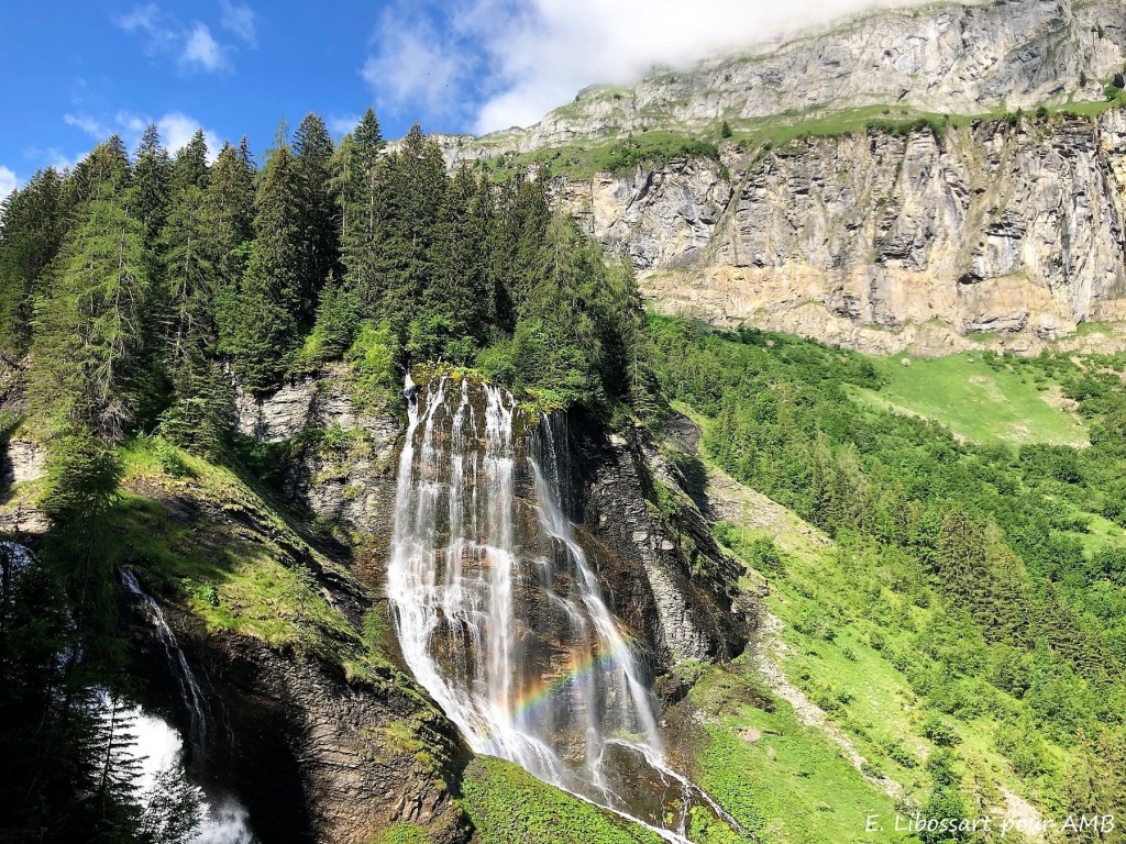
ANTERNE LAKE AND PASS
The day begins through the woods, alongside the Rouget, Pleureuse and Souffraz waterfalls. Climb to the Anterne pasture at the heart of the Sixt-Passy Nature Reserve, a wide high plateau where one of the most beautiful lakes in the area is nestled. Here is the kingdom of marmots and rare bearded vultures! Skimming stone contest followed by a short climb to the Anterne pass and descent to the Moëde-Anterne refuge. Night in dormitory without luggage transfer and without shower.
7 hours walk / Elevation : + 1550 m ; - 400 m / Distance : 15 km
ENVERS DU BREVENT - CHAMONIX
Short descent towards the Arlevé bridge. Here the landscape changes, the Fiz limestones give way to the red rocks of the Aiguilles Rouges range. Climb up to the Brévent pass (2368m) then descend to Planpraz to take the gondola down to Chamonix.
5 hours walk / Elevation : + 750 m ; - 750 m / Distance : 10 km
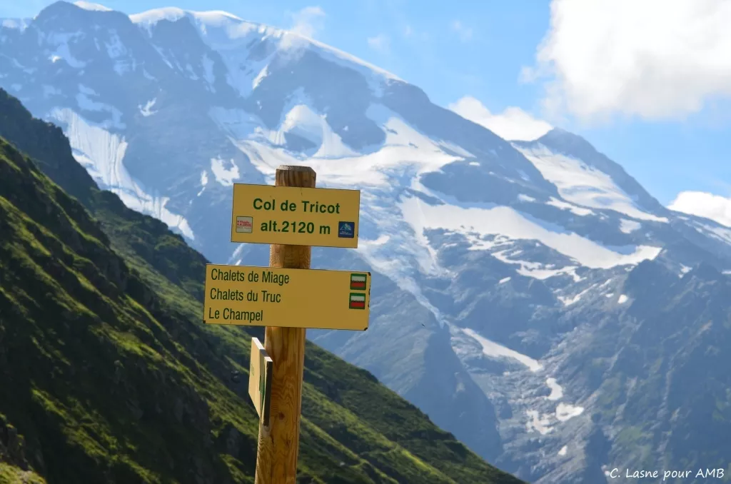
LES HOUCHES - LES CONTAMINES
Take the cable car and depart on foot from 1800m. Crossing to the foot of the Bionnassay Glacier before climbing to the Tricot pass. Descend to the Miage chalets and on to Les Contamines. Night in a small dormitory in a village gîte.
5.5 hours walk / Elevation : + 650 m ; - 1250 m / Distance : 11 km
COL DE LA CROIX DU BONHOMME - CORMET DE ROSELEND
Climb via the Roman road to the famous mountain pass, 'Col du Bonhomme'. Descend via the Crête des Gittes and the vast Beaufortain pastures to arrive at Plan de la Lai. Night in a dormitory above Lake Roselend.
6.5 hours walk / Elevation : + 1450 m ; - 800 m / Distance : 17 km
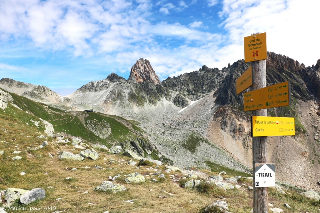
COL DU BRESSON, SOUS LA PIERRA MENTA - ROSUEL
Balcony trail overlooking Lake Roselend and climb to the Bresson pass (2469m) at the foot of the Pierra Menta mountain. Descend through the Ormette valley and alongside small water channels in the hamlets to reach Valezan, part of the Tarentaise valley. Taxi transfer to Peisey Nancroix and 'La Porte de Rosuel'. Night in a dormitory in a refuge.
7 hours walk / Elevation : + 900 m ; - 1200 m / Distance : 16 km
COL DU PLAN SÉRY - CHAMPAGNY LE HAUT
Enter into the Vanoise National Park at the foot of Mont Pourri and Dôme de la Sache. After the Lake of La Plagne, the ascent of the Plan Séry pass leads into the Vallaisonnay valley and its amazing geology. A final descent along the Py waterfall to the various hamlets of the Champagny valley. Night in a gite at Champagny-le-haut.
7 hours walk / Elevation : + 1050 m ; - 1150 m / Distance : 18 km
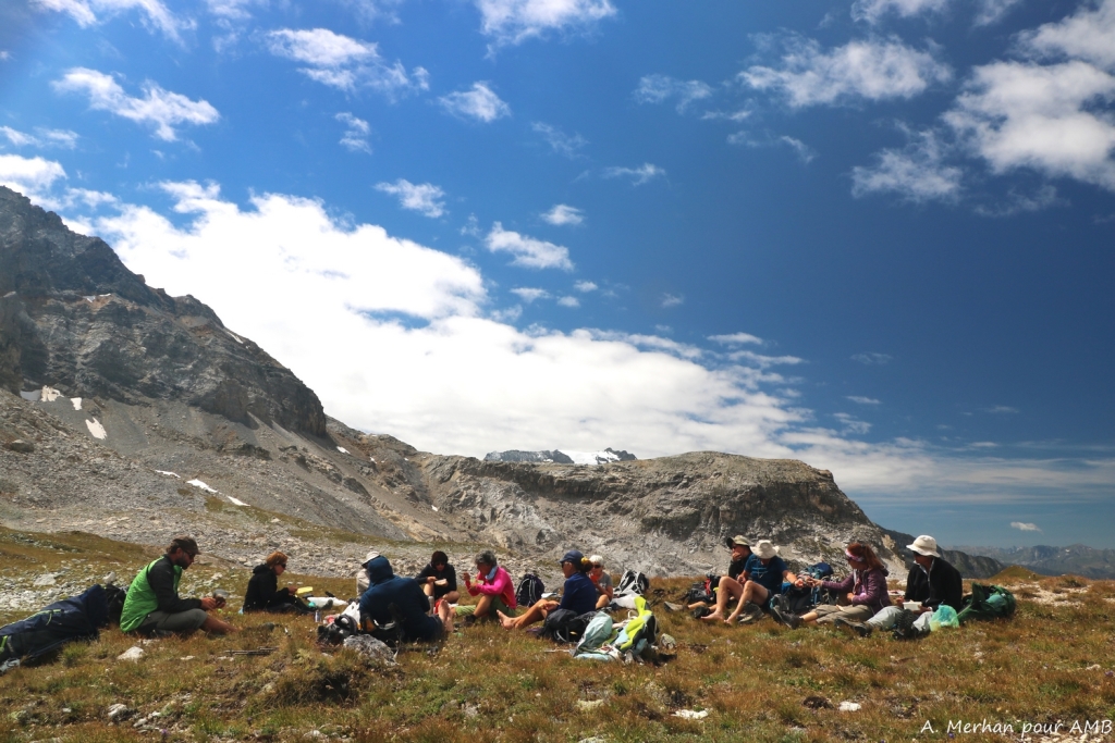
TOUR DU MERLE - REFUGE DU GRAND BEC
The hike starts in a large spruce forest, the path rises to pass through all levels of vegetation until it reaches the Grand Bec refuge. Set on its promontory, it enjoys a large view of the glaciers above and the Pralognan valley below. Possibility to go through the very alpine col des Galinettes (2750m) depending on the conditions.
Night in a dormitory in the refuge without luggage transfer (and without shower).
5.5 hours walk / Elevation : + 1250 m ; - 300 m / Distance : 10 km
Add +/- 100 m by the col des Galinettes
COL DE LESCHAUX - LES PRIOUX
After leaving the refuge begins a wild traverse to the Leschaux pass. From there, the path goes on a balcony with the Vanoise glaciers and the Grande Casse (3855 m) in sight. The path is impressive but well marked and chained to the famous 'Lac des Vaches'. A final descent takes you to the village of Pralognan. From the 'Col de Leschaux', or from the regfuge, a second route allows you to avoid the balcony path in case of bad weather. Night in a dormitory in refuge.
7 hours walk / Elevation : +900 m ; -1600 m / Distance : 17 km
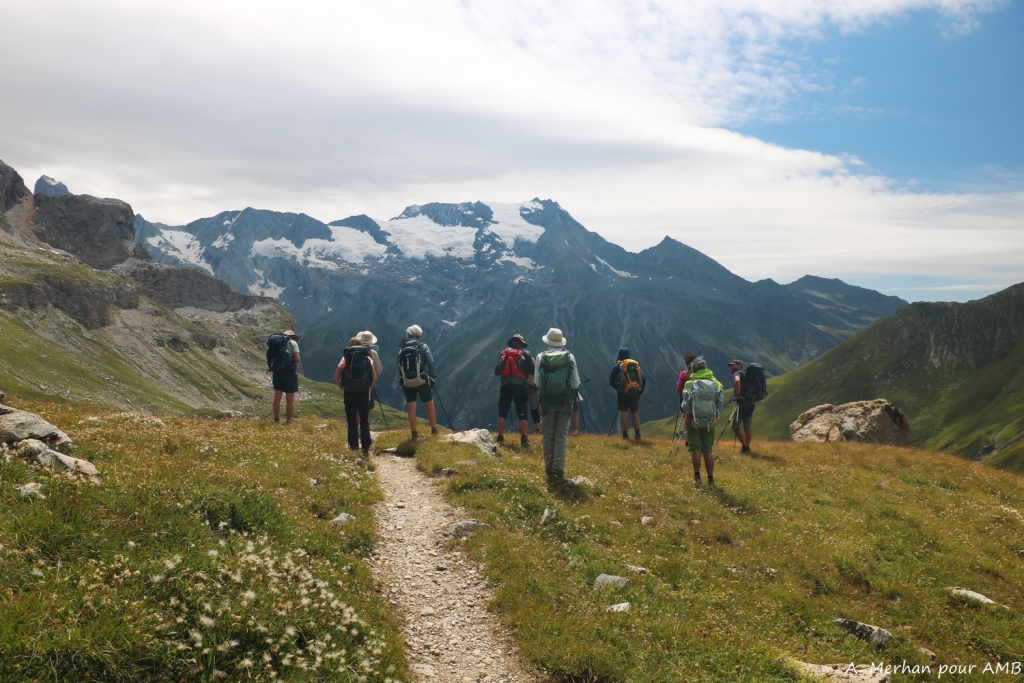
CHAVIÈRE PASS - MAURIENNE VALLEY
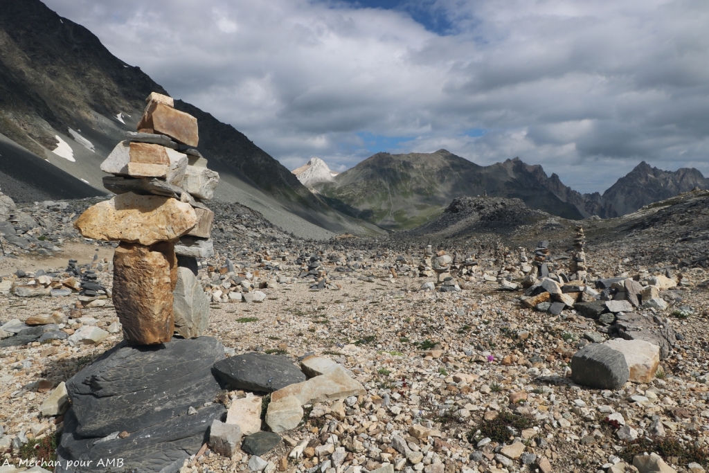
Climb Chavière valley dominated by the Domes de la Vanoise in a lunar landscape punctuated by cairn forests (piles of stones). The Aiguilles de Péclet-Polset indicate the nearby Chavière Pass. Descend into the Maurienne Valley through the pastures. Short transfer to Modane from Porte de l'Orgère.
6 hours walk / Elevation : + 1150 m ; - 950 m / Distance : 16 km
MODANE - VALLEE ETROITE
Transfer to Valfréjus (20min) to the famous departure point of the GR5, towards the Étroite valley. Gentle climb towards this mountain pass which acts as a natural border between the Northern and the Southern Alps. Here enter the Hautes-Alpes and Étroite Valley, a French enclave in Italy. Descent to the hamlet of Les Granges to spend the first night in a refuge.
5 hours walk / Elevation : + 890 m ; - 720 m / Distance : 14 km
VALLÉE ÉTROITE - COL DU VALLON - NÉVACHE
Let's go at the heart of the Clarée Valley. In that very wild area, climb to the Vallon pass (2645m) dominating the great Lake Blanc. A nice descent towards the Nevache village in the upper Clarée Valley. Cross the traditional village of Ville Haute and transfer (35min) at the end of the day to the neighbouring Fonts de Cervières valley. Night in refuge.
6 hours walk / Elevation : + 850 m ; - 1050 m / Distance : 13 km
FONTS DE CERVIÈRES - COL MALRIF - ABRIÈS
Reaching the Queyras National Park via the Malrif pass (2830m). A beautiful climb from the Fonts de Cervières hamlet. Cross the Marif pass with a breathtaking view of the famous Mont Viso, the Lord of the Southern Alps. A long descent to Abriès via the Malrif lakes which are among the largest in the Queyras region.
6 hours walk / Elevation : + 850 m ; - 1300 m / Distance : 15 km
ECHALP - LAKE VALLEY - COL VIEUX - LAKE BLANCHE
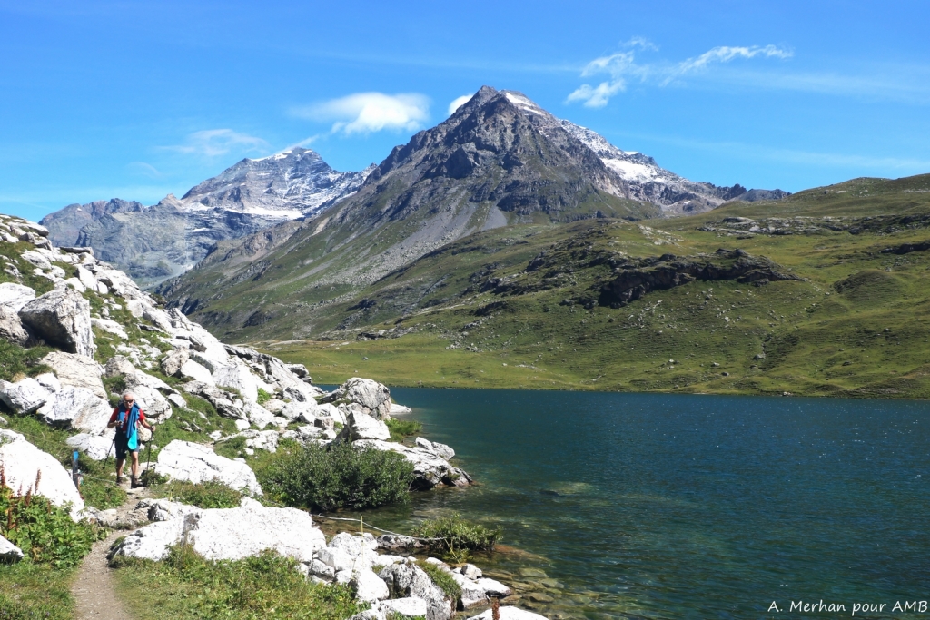
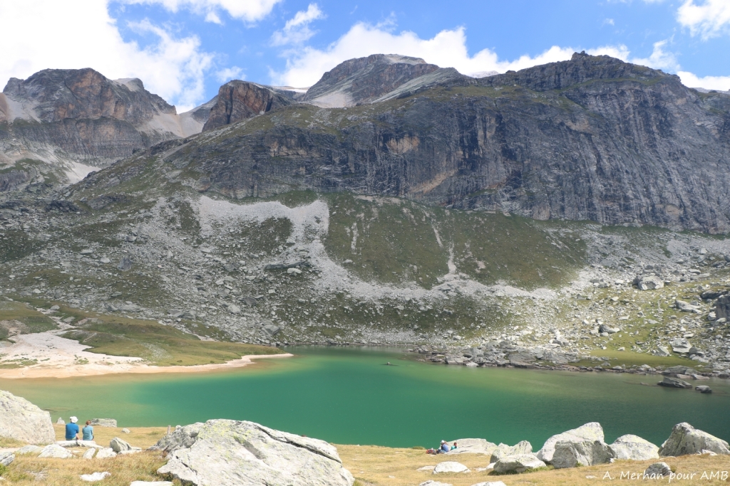
From the last hamlet of this high valley of Guil, up along the Italian border, the valley of Bouchouse which constitutes a biotope reserve. Passage to Egorgeou and Foréant lakes and then to "Col Vieux" (2806m) to reach "Col de Chamoussière". Descent into this wide valley of the "Aigue Blanche" to reach the "refuge de la Blanche", by the lake, nestled at the foot of the "Tête des Toilies".
Night without luggage transfer.
6 hours walk / Elevation : + 1400 m ; - 600 m / Distance : 15 km
LAKE BLANCHE - COL DE LA NOIRE - MALJASSET
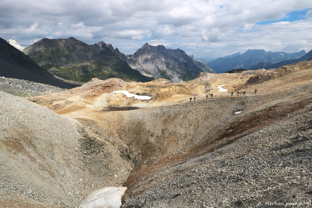
From the refuge, in its extraordinary landscape, climb to the mineral area of Col de de la Noire. Leaving behind the Queyras region to enter the wild valley of Haute-Ubaye. Gently descending into the flower filled Longet valley to the first hamlet of Maljasset.
7.5 hours walk / Elevation : + 550 m ; - 1300 m / Distance : 15 km
MALJASSET - COL MARY - CHIAPPERA
At the foot of the highest range of Haute-Ubaye, the Chambeyron (3412m), an easy climb through the Col Mary Valley with its multitude of lakes cheerfully dotting the pastures. From the mountain pass enter Italy, to the Piedmont to reach the Val Maira and the beautiful village Chiappera. Night in a gîte, without luggage transfer.
5.5 hours walk / Elevation: + 815 m ; - 1150 m / Distance : 18 km
CHIAPPERA - COL DES MONGE - ORONAYES VALLEY - LARCHE
Nice traverse in the unusual Maira Valley to reach the "Col des Monges" (2542m) marking the border between France and Italy. Descend into the Montagnette Valley dominated by the fortresses of Maginot erected during the Second World War. Arrive in Larche, a small village of Haute-Ubaye.
6 hours walk / Elevation : +/- 1150 m / Distance : 16 km
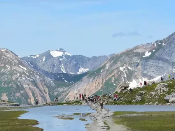
LARCHE - VALLON DU LAUZANIER - PAS DE LA CAVALE
Departure for the Lauzanier Valley at the gates of the Mercantour National Park. Climb via a pleasant path to reach the Lauzanier Lake before a final slightly steeper climb up to the pass. A magnificent view from Col de la Cavale of the Tinée and the surrounding mountains. Descend into the high valleys of the Alpes Maritimes passing via the Col des Fourches and the magnificent promontory of Mont des Fourches. Reaching the Bonnette Restefond road (the highest road in Europe) encountering poignant vestiges of the Maginot line. Night in Bousiéyas, the first hamlet in this high valley of Tinée.
6 hours walk / Elevation : + 1040 m ; - 1100 m / Distance : 20 km
ISOLA 2000 - COL DE LA MERCIERE - LE BORÉON
After an early transfer to Isola 2000 ski resort, climb to the Col de la Mercière (2342m). Descend and then cross through the old village of Mollière and up to Salèze pass. Depending on the wheather conditions and on the group, a detour is possible to Lake Negere. Descend into the Vésubie to the village of Boréon.
Night in a gite.
5.5 hours walk / Elevation: + 550 m ; - 1090 m / Distance : 18 km
LE BORÉON - PAS DES LARDES - MADONE DE LA FENESTRE - LACS DE PRALS - LA GORDOLASQUE
From Boreon, climb through the valley towards the lakes of Trécolpas to cross the Pas de Lardes (2448m) dominated by the Gelas, highest summit of the Mercantour. Descend to the hospices of the Madone de Fenestre passing near its cheese cave. Through the Poncet Valley to the lower lakes and then on to the 5 lakes of Prals before going up to Lower Prals. Beautiful descent into the Gordolasque Valley, in the Relais des Merveilles.
7.5 hours walk / Elevation : + 1550 m ; - 1520 m / Distance : 20 km
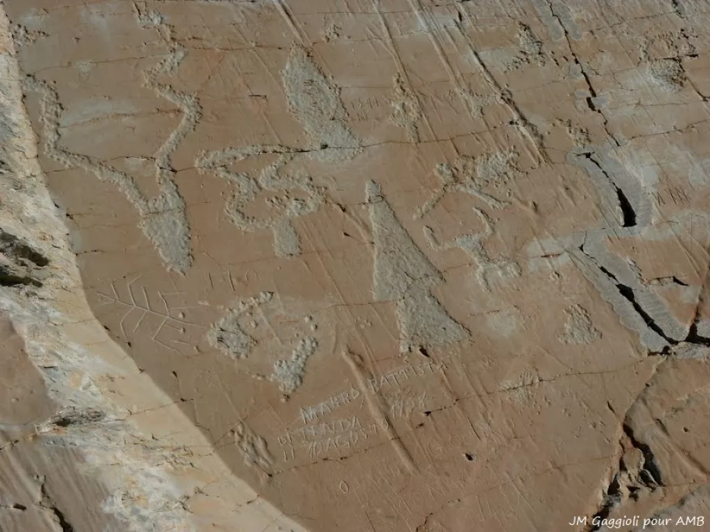
VALLÉE LA GORDOLASQUE - REFUGE DE NICE - BAISSE DE VALMASQUE - VALLÉE DES MERVEILLES
Climbing through the Gordolasque Valley to Lac de la Fous and Refuge de Nice which dominates. Travelling light for a night without baggage transport to the Refuge des Merveilles.
From Refuge de Nice, climb to Baisse Basto to join the famous Vallée des Merveilles and its engraved caves. A succession of enchanting lakes in the middle of this mineral landscape typical of this valley full of history.
6.5 hours walk / Elevation : + 1300 m ; - 790 m / Distance : 16 km
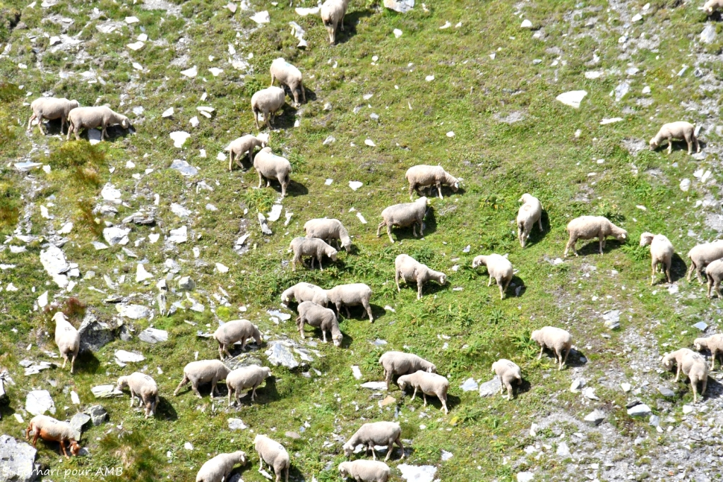
REFUGE DES MERVEILLES - PAS DU DIABLE - COL DU RAUX - L'AUTHION - CAMP D'ARGENT
Via a multitude of lakes, leave the Vallée des Merveilles by the Pas de Diable. Change of scenery starting from the Pas de Diable where we will cross several mountain passes at medium altitude through sheep pastures. At the Col du Raux, heading back to the small plateau of Authion dominated by a remarkable redoubt, a high place of confrontation during the Second World War. From Authion on a clear day is our first sighting of the Mediterranean. Descend to the small ski resort of Camp d'Argent.
5.5 hours walk / Elevation : + 625 m ; - 1000 m / Distance : 13 km
CAMP D'ARGENT - MONT VENTABREN - MANGIABO - SOSPEL
A magnificent day on a ridge awaits. Leaving these landscapes rich in military vestiges of the Second World War to reach Sospel via the Mount Ventabren and Mangiabo ridges. With a continuing view over the mouth of the Var and the outskirts of Nice. A Charming descent to the village of Sospel on the Bévéra river for the night.
7 hours walk / Elevation : + 570 m ; - 1750 m / Distance : 22 km
SOSPEL - COL DU RAZET - VIEUX CATSELLAR - MENTON
Last day of the GTA, not there yet... but can you smell the sea?! Beautiful climb to the Col de Razel (1032m) on an old paved path between ruined shepherd huts. Passing flocks of sheep and goats from Rove testifies to the arrival in Provence. The vegetation becomes much more leafy and fragrant. Chestnut trees, maples and rosemary line this beautiful day. Enjoy the last mountain pass, Col du Berceau (1050m) to picnic overlooking the bay and harbour of Menton. A final descent of 1050m to the waters edge!
6.5 hours walk / Elevation : + 1110 m ; - 1450 m / Distance : 18 km
End point around 4.30 pm in Menton harbour.
The itinerary is established according to the latest information available, the possibility of unknown factors affecting this itinerary is possible including situations beyond our control which may change the route, timings etc. (depending on the natural conditions and the fitness of the group).
Dates and prices
From Sun 28/06/2026
To Sat 25/07/2026
From Sun 05/07/2026
To Sat 01/08/2026
From Sun 12/07/2026
To Sat 08/08/2026
From Sun 19/07/2026
To Sat 15/08/2026
From Sun 26/07/2026
To Sat 22/08/2026
From Sun 02/08/2026
To Sat 29/08/2026
From Sun 16/08/2026
To Sat 12/09/2026
Secure payment
THE PRICE
The price includes:
- Organisation and booking fees, guiding by a qualified mountain leader;
- Accommodation with half-board formula (except night 14 in B&B), lunch picnic and snacks;
- Tourist tax;
- Luggage transfer except day 1, 4, 6, 12, 18, 20 and 25;
- Bus transfers as described in the technical facts.
The price does not include:
- Personal expenses (drinks, etc.), touristic visits;
- Luggage transfer on days 1, 4, 6, 12, 18, 20 et 25.
- Dinner on day 14;
- Cancellation insurance;
- Your return journey from home to the point of departure/end point.
The price is all inclusive from departure to end point.
Also available a la carte
Contact us!Technical sheet
LEVEL ***
Elevation: around +/- 700m - 1300m per day.
Walking time: 5 to 7 hours per day.
Type of trek: mountain route on trails with some well equipped aerial sections.
You need to be in good physical condition and mentally fit for long efforts. Regularly practice an endurance sport such as walking, running or cycling, for 6 to 8 hours a week. Your physical preparation will make your trek easier and more enjoyable. Click here for a description of the different levels: hiking level.
GUIDING
Group from 6 to 14 people supervised by a guide. The mountain leader may adapt the programme to suit the level of the group and/or the natural conditions. As a last resort, he is the sole decision-maker.
As a thank-you, it's common practice to tip your guide at the end of your tour, depending on your satisfaction. This is not obligatory, but it is greatly appreciated.
ACCOMMODATION
CLASSIC: 27 nights in mountain chalets, refuges and gites.
Hot showers in all accommodations (except at the Grand Bec refuge on day 12).
MEALS
Breakfast and dinner are provided in each accommodation. Picnics are included and are carefully prepared daily by your guide, comprising a variety of healthy salads and local products. Please inform us about your food allergies and special diets at the time of booking. We do our best to accommodate special diets (gluten-free, vegetarian etc.). However, we encourage you to bring some additional products for your own picnics.
CURRENCY
Please bring cash for drinks and personal expenses, as not all accommodations accept credit cards.
ACCESS TO DEPARTURE POINT
Meeting point at 12pm in front of Thollon-les-Mémises Tourist Office.
Transfer option: pick up in Chamonix and transfer to the departure point. Optional service at €50 per person, to be booked on registration. Meet with your luggage at 8:45am at the Prarion cable car in Les Houches (bakery, free parking where you can leave your car) or at 9:30am at the Chamonix SNCF train station.
BY TRAIN
Go: TGV line Paris/Bellegarde/Evian, then regular bus service from Evian to Thollon Les Mémises (40 mins).
Please check oui.sncf for timetables.
Return: the shuttle can take you to Menton train station, where you can reach Nice (40 mins). Then, you can take the train or the plane to major destinations (arrival at Nice train station no earlier than 6pm). Night train : Nice - Paris, TGV. Shuttle available between Nice train station and Nice airport.
BY CAR
Getting there: A40 freeway, Annemasse exit (free parking), then bus (sat-leman line 141) or train to Evian, then bus to Thollon-les-Mémises.
Free car park in Thollon, Chamonix or Annemasse. Or secure parking: Chamonix Park auto +334 50 53 65 71.
CAR-SHARING
Get in touch with people to share a lift! www.blablacar.fr www.laroueverte.com www.roulezmalin.com
CLOSEST AIRPORTS
Geneva (GVA) - Lyon (LYS) - Paris (PAR)
End of the hike on Saturday around 4:30p.m. your bags will be in the hotel you have booked (if you have taken the luggage transport option). If you leave Menton directly after the hike, we will drop off your bags at a hotel near the station (the hotel will charge us €15 per bag if you do not stay overnight).
ACCOMMODATION BEFORE AND AFTER
Thollon Les Mémises
Evian-les-Bains
Chamonix Tourist Office : +33 (0)4 50 53 00 24
If you book an overnight stay in the Chamonix valley, you can ask for a guest card at reception for free access to public transport.
TO CONTACT US
If you are late please contact the agency as soon as possible on: +33 (0)4 50 79 09 16 or +33 (0)6 42 49 76 07
EQUIPMENT LIST
Clothing
- Walking trousers
- Shorts (Bikini/swimsuit, just in case!)
- Breathable or merino wool t-shirts
- Breathable or merino wool leggings
- Fleece or jumper
- Wind stopper or Goretex jacket
- Lightweight down jacket
- Waterproof poncho + gaiters or Goretex trousers + waterproof rucksack cover
- Pair of gloves and a warm hat
- Sun hat or baseball cap
- Walking socks (1 pair per day)
- Sturdy walking boots with a good sole, already broken in
- 1 change of clothes for the evening
- A pair of comfortable shoes for the evening
Other Equipment
- Toilet bag
- Quick drying towel
- Sunglasses and sun cream
- Water bottle or Camelback (1.5 litre minimum)
- Knife, fork and spoon
- Plastic lunch box/plate for your picnic lunches (0.40L to 0.50L)
- Plastic cup for coffee
- Small First Aid kit (antihistamine, ibuprofen, Compeed type blister pads...)
- Survival blanket
- Head torch or hand torch
- Sleeping bag liner sheet and pillowcase (blankets provided at accommodation)
- Two adjustable walking poles (highly recommended)
- Identity card or passport
BACKPACK
Bring a comfortable backpack of 30 to 40 litres for your personal belongings for the day (warm clothes, waterproofs, water, plate and cutlery for your picnic, sunscreen and your identity papers) and please keep a little room to carry a picnic and snacks.
LUGGAGE TRANSFER
You are allowed 1 soft, sports type bag, with all your possessions inside, of 10kg maximum per person. Your baggage will be transported daily between accommodation by our logistics vehicle where access is not always easy.
Baggage which is too big and too heavy won't be accepted by the drivers, please think of their backs!
YOUR BACKPACK FOR YOUR NIGHTS WITHOUT LUGGAGE TRANSFER
On nights 1, 4, 6, 12, 18, 20 and 25, your luggage won't be dropped off at your accommodation (you will get it back the day after). Here are the things to bring with you (about 2 kilos are enough!):
- Small toiletries bag
- Sleeping bag liner sheet
- Change of clothes for the day after (bare necessities!) and comfortable for the evening.
Customer Reviews
-
27/08/2021


Stacy
Malgré le temps, ce fut une superbe randonnée ! Notre guide Bruno était parfait.