GRANDE TRAVERSEE DES ALPES self-guided - sections 1, 2, 3 and 4

Hiking details
28 Days 28 Days
Self-guided Self-guided
With baggage transportation With baggage transportation
Accommodation Classic or comfort
Level *** Level ***
From 2700 € From 2700 €

From Lake Geneva to Menton

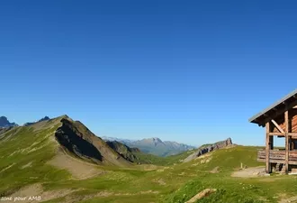
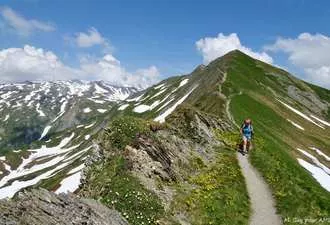
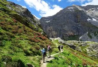
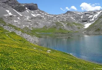
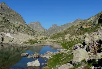
Cross the Alps meeting people and mountains... The Grande Traversée des Alpes (GTA) between Lake Geneva and the Mediterranean is a long-distance hike. The opportunity to take a long break and put daily life aside.
This itinerary runs along the Swiss and Italian borders while crossing five counties and some of the most famous mountain ranges in the Alps.

You will like

  • Crossing mountain ranges, the geology and the varied landscapes
  • Rich ecosystems, abundant wildlife and valleys full of history
  • Baggage transport possible
  • Between each section of the tour the night B&B is a gift from us!
Lire les avis clients

Share on :

GRANDE TRAVERSEE DES ALPES self-guided - sections 1, 2, 3 and 4

From 2700 €

Book online
Secure payment
Secure payment

Circuit

Hiking details

See the technical informations

Dates & prices

DEPARTURES AND PRICES

Daily departure from 23rd of June to 2nd of September 2024

Classic version in 28 days

Without baggage transport
2700€ per person (based on 2 people)
Single departure supplement : 485€

With baggage transport (except on days 1, 4, 6, 10, 12, 13, 20 and 25)
2 persons : 3640€/ person
3 persons : 3450€/ person
4 persons : 3180€/ person
5 persons : 3120€/ person
6 persons : 3025€/ person
Single departure supplement : please contact us

Information and bookings by telephone or email.

Secure payment Secure payment
Book online

THE PRICE

Includes: 

  • Accommodation with half-board formula except the night in Modane (B&B);
  • 1 hard copy of your travel documents for the group and the digital version for each participant;
  • Daily baggage transport between accommodation if you have chosen this option (except on days 1, 4, 6, 10, 12, 13, 20 and 25) ;
  • Transfer on day 3, day 10, day 15, day 23
  • Organisation and booking fees, taxes.

The price does not include:

  • Picnic lunches ;
  • Dinner of Day 14 ;
  • Shower tokens ;
  • Personal expenses, drinks, touristic visits, etc.;
  • The cable car at Thollon (around 7€/ person) and descent on cable car at Brévent (around 18€/ person);
  • The cable car at Les Houches (around 18€/ person/ trip);
  • Travel insurance.

The price is all inclusive from departure to end point.

The itinerary day by day

Day 1

Start of the hike at Thollon-Les-Mémises gondola ( where your luggage will be taken, if you choose the option)

THOLLON LES MEMISES - PIC DES MEMISES - ALPAGE OF NEUVA
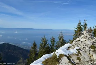
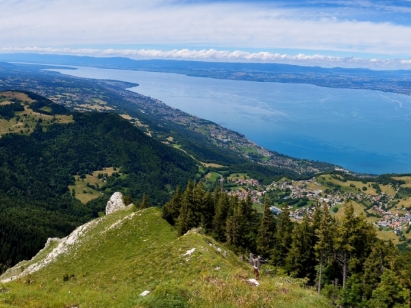
Way up with the cablecar and depart towards the balcony trail overlooking Lake Geneva. Then traverse the Mémises range and Mottay alpine pastures before descending to Novel valley. Night in refuge without baggage.
3.5 - 4 hour walk / Elevation: +350m -500m

Day 2

BISE PASS - CHAPELLE D’ABONDANCE 
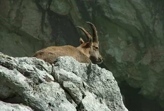
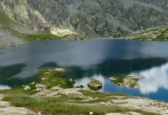
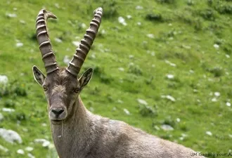
From the refuge, climb to lake Neuteu and Bise pass. Detour possible by Lake Darbon, under the mocking eyes of the ibex ! Descend into Bise Valley, climb to Pas de la Bosse and descend to La Chapelle d'Abondance, a typical village. Night in gite.
6 - 6.5 hour walk / Elevation: +900m -1350m

Day 3

COL DE BASSACHAUX - LINDARETS (Goat village) - VALLÉE DE LA MANCHE
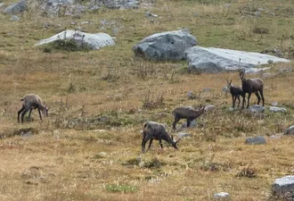
Climb up to Pointe des Mattes in the Mont de Grange nature reserve, where you can spot chamois. Crossing through the pastures of Abondance to reach Bassachaux pass, overlooking Lake Montriond. Descend to the pretty village of Lindarets, well-known for its goats ! Transfer to Vallée de la Manche. Night in refuge.
6.5 - 7 hour walk / Elevation: +1250m -750m

Day 4

COL DE LA GOLÈSE - FOLLY REFUGE
Climb to the pastures and farm of Fréterolles, its cows, its goats and its cheese! Cross at the foot of the Terres Maudites and then short climb to Golèse pass (1666m). Descend to the hamlet Les Allamands. Climb under the rock slabs of Tuet to reach the Folly refuge for a night overlooking the distant lights of the Giffre Valley. Night in refuge without your baggage.
6 - 6.5 hour walk / Elevation: +1050m -990m

Day 5

VOGEALLE LAKE - SIXT-FER-À-CHEVAL
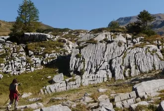
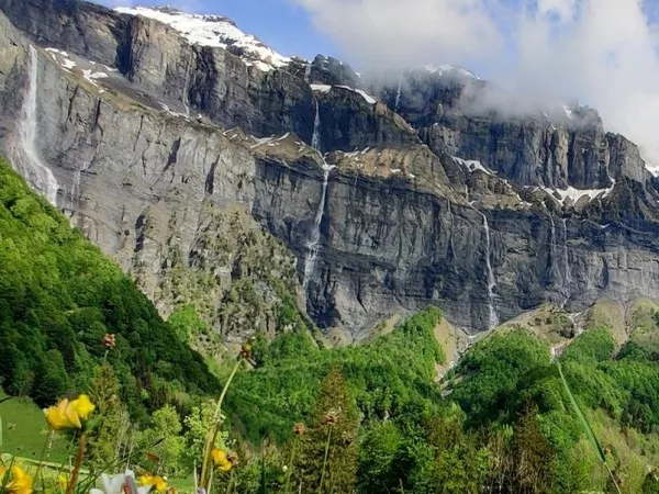
Day in the wild range of Dents Blanches. Depart towards the Combe aux Puaires, an unusual area of lappiaz (eroded limestones). Descend to Lake Vogealle. Follows a beautiful descent facing the waterfalls of the cirque of Bout du Monde and Sixt-Fer-à-Cheval.
5.5 - 6 hour walk / Elevation: +700m -1250m

Day 6

COL D'ANTERNE - REFUGE MOËDE-ANTERNE
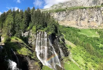
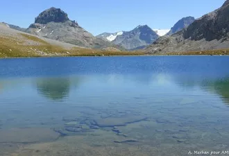
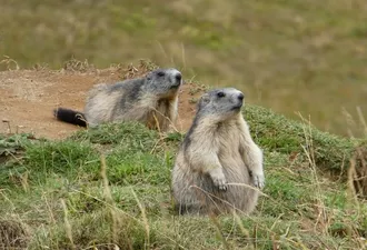
Climb to the Rouget waterfall and then to the Pleureuse and the Sauffaz waterfalls. The trail reaches the pastures of Anterne at the heart of the natural reserve of Sixt-Passy, a vast and high plateau where one of the most beautiful lakes nestles. Kingdom of marmots and rare bearded vultures! Another small climb to Col d'Anterne and descend to Moëde-Anterne refuge. Night in refuge, without baggage.
6 - 6.5 hour walk / Elevation: +1500m -350m

Day 7

COL DU BREVENT - CHAMONIX
Short descent towards the Arlevé bridge. The landscape changes, the Fiz limestone gives way to the rocks of the Aiguilles Rouges range. Climb up to Brévent pass (2368m), then descend to Planpraz to take the cable car down to Chamonix.
5 hour walk / Elevation: +800m; -800m 
Extra 1.5 hour walk if descending by foot to Chamonix: -1000m added

Day 8

LES HOUCHES - COL DU TRICOT - CONTAMINES
Take the cable car and walk between valleys and forest to start your day, before climbing to the Col du Tricot, in front of the Bionnassay glacier. After a coffee break, descend to the village Les Contamines and Notre-Dame-de-la-Gorge. Night in refuge.
5 - 5.5 hour walk / Elevation: +600m -1250m
1 hour walk / Elevation: +250m from Les Contamines to Nant Borrant

Day 9

COL DU BONHOMME - CORMET DE ROSELEND
Climb up along the Roman road to the famous Col du Bonhomme on the Tour of Mont Blanc. Then cross the Gittes ridgeline and traverse through the vast Beaufortain pastures at Cormet de Roselend. 
6 - 6.5 hour walk / Elevation: +1350m -700m

Day 10

COL DU BRESSON - PORTE DE ROSUEL
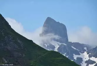
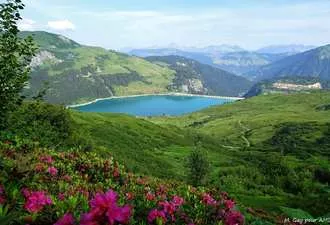
Balcony trail overlooking Lake Roselend and climb up to the Col du Bresson at the foot of the Pierra Menta. Descend to the valley of Ormette to reach the Tarentaise valley. Taxi transfer from the Saint Guérin chapel to reach Peisey Nancroix and Rosuel. Night in refuge without baggage.
6 - 6.5 hour walk / Elevation: +950m -1170m

Day 11

COL DE LA SACHETTE - TIGNES
Enter into the Vanoise National Park at the foot of Mont Pourri and the Dome de la Sache. Detour possible to the lake in La Plagne before climbing to the Col de la Sachette (2713m). Descend into The Sache Valley and the Tignes-Champagny natural reserve to the village of Tignes les Boisses (optional way via the Col du Palet). Night in a hotel.
6 - 6.5 hour walk / Elevation: +1200m -850m

Day 12

VALLEY OF LA LEISSE - COL DE LA VANOISE
Short transfer by local bus to the Val Claret village. Discover the wide spaces of the Vanoise National Park and climb up to the Col de la Leisse. Descend the Leisse Valley with its lakes. The south face of the Grande Casse (1700m) overlooks the trail. Night in refuge without baggage.
6.5 - 7 hour walk / Elevation: +1100m -650m

Day 13

CIRQUES DU PETIT AND GRAND MARCHET
Leave the refuge and take the balcony trails overlooking the Pralognan Valley: Combe de l'Arcelin, Cirque du Dard, Grand Marchet, Petit Marchet, Valette Lake and Combe des Nants. Descend into the Prioux Valley. Night in refuge without baggage.
6.5 - 7 hour walk / Elevation: +1000m -1800m

Day 14

COL DE CHAVIERE - VALLEE DE LA MAURIENNE
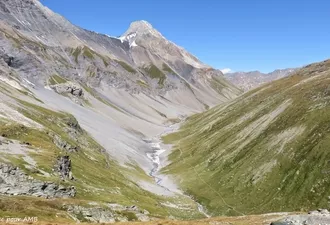
Walk up to the Chavière Valley dominated by the Dômes de la Vanoise, in a moon-like world, dotted with cairn forests. The Aiguilles de Péclet-Polset show us the col de Chavière nearby. Walk down into the Valley of Maurienne among the pastures, towards Modane. 
6 - 6.5 hour walk / Elevation: +1150m -950m to the Orgère refuge
1.5 hour walk / Elevation -880m additional descend to Modane on foot

Day 15

MODANE - VALLEE ETROITE PASS
Transfer to Valfréjus (20mins) to the famous departure point of the GR5, towards the Étroite Valley. Gentle climb towards the mountain pass which acts as a natural border between the Northern and the Southern Alps. Enter the Hautes-Alpes and Étroite Valley, a French enclave in Italy. Descent to the hamlet of Les Granges.
5 hour walk / Elevation: +850m -720m

Day 16

VALLÉE ÉTROITE - COL DU VALLON - NÉVACHE
Turn back on the trail to sink into the heart of the Clarée Valley. In an extremely wild area, climb to the Vallon pass (2645m) overlooking the magnificent Lake Blanc. A beautiful descent towards the Nevache village in the upper Clarée Valley. Cross the traditional village of Ville Haute.
6 hour walk / Elevation: +850m -1050m

Day 17

FONTS DE CERVIÈRES - COL MALRIF - ABRIÈS
Transfer to Fonts de Cervières (50 min). Reach the Queyras National Park via the Malrif pass (2830m). A beautiful climb from the Fonts de Cervières hamlet. Cross the Malrif pass with a breathtaking view of the famous Mont Viso, the Lord of the Southern Alps. A long descent to Abriès via the Malrif lakes which are among the largest in the Queyras region. Night in gite.
6 hour walk / Elevation: +850m -1300m

Day 18

ECHALP - LAKE VALLEY - COL VIEUX - LAKE BLANCHE
Going up along the Italian border, the valley of Bouchouse is a biotope reserve. Passage to Egorgeou and Foréant lakes and then to "Col Vieux" (2806m) to reach "Col de Chamoussière". Descent into this wide valley of the "Aigue Blanche" to reach the refuge de la Blanche by the lake, nestled at the foot of the "Tête des Toilies". Night without baggage.
6 hour walk / Elevation: +1400m ; -600m

Day 19

LAKE BLANCHE - COL DE LA NOIRE - MALJASSET
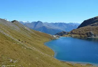
From the refuge, in this extraordinary landscape, climb to the mineral area of Col de la Noire. Leaving behind the Queyras region to enter the wild valley of Haute-Ubaye. Gently descending into the flowered Longet Valley to the hamlet of Maljasset. Night in gite.
7.5 hour walk / Elevation: +550m -1300m

Day 20

MALJASSET - COL MARY - CHIAPPERA
At the foot of the highest point of the range of Haute-Ubaye, the Chambeyron (3412m) climb via the Col Mary Valley with its multitude of lakes cheerfully dotting the pastures. From the mountain pass, enter Italy, to reach the Val Maira and the beautiful village of Chiappera. Night in gite, without baggage.
5.5 hour walk / Elevation: +815 m ; -1150 m

Day 21

CHIAPPERA - COL DES MONGE - ORONAYES VALLEY - LARCHE
Nice traverse in the unusual Maira Valley to reach the "Col des Monges" (2542m) marking the border between France and Italy. Descend into the Montagnette Valley dominated by the fortresses of Maginot erected during the Second World War... Arrive in Larche, a small village of Haute-Ubaye.
6 hour walk / Elevation: +1150 m ; -1150 m

Day 22

LARCHE - VALLON DU LAUZANIER - PAS DE LA CAVALE
Depart towards the Lauzanier Valley at the gates of the Mercantour National Park. Climb via a pleasant trail to reach the Lauzanier Lake before a final slightly steeper climb up to the pass. Great view from Col de la Cavale on the Tinée and the surrounding mountains. Descend into the high valleys of the Alpes Maritimes passing via the Col des Fourches and the magnificent promontory of Mont des Fourches. Reaching the Bonnette Restefond road (the highest road in Europe) encountering poignant vestiges of the Maginot line. Night in Bousseyas.
6 hour walk / Elevation: +1040m ; - 1100m

Day 23

ISOLA 2000 - COL DE LA MERCIERE - LE BORÉON
Early transfer to Isola 2000 ski resort, then climb to the Col de la Mercière (2342m). Descend and then cross through the old village of Mollière and up to Col De Salèze. Depending on the condition and the fitness level of the group a detour is possible to Lake Negere. Descend into the Vésubie to the village of Boréon. Night in gite.
5.5 hour walk / Elevation: + 550 m ; - 1090 m

Day 24

LE BORÉON - PAS DES LARDES - MADONE DE LA FENESTRE - LACS DE PRALS - LA GORDOLASQUE
From Boreon, climb through the valley towards the lakes of Trécolpas to cross the Pas de Lardes (2448m) overlooked by the Gelas, highest summit of the Mercantour. Descend to the hospices of the Madone de Fenestre passing near the cheese cave. Climb up the Poncet Valley to the Baisse des lacs and then to the 5 lakes of Prals before going up to the Baisse des Prals. Beautiful descent into the Gordolasque Valley. Night in refuge.
7.5 hour walk / Elevation: + 1550m ; - 1520m

Day 25

VALLÉE LA GORDOLASQUE - REFUGE DE NICE - BAISSE DE VALMASQUE - VALLÉE DES MERVEILLES
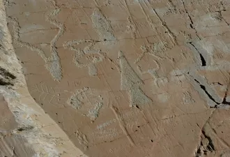
Climb through the Gordolasque Valley to Lac de la Fous and Refuge de Nice which dominates. Light package for a night without baggage at refuge des Merveilles.From Refuge de Nice, climb to Baisse Basto to join the famous Vallée des Merveilles and its engraved caves. Be enchanted by numerous enchanting lakes in that mineral landscape.
6.5 hour walk / Elevation: + 1300m ; - 790m

Day 26

REFUGE DES MERVEILLES - PAS DU DIABLE - COL DU RAUX - L'AUTHION - CAMP D'ARGENT
Leave the Vallée des Merveilles by the Pas de Diable. Change of scenery starting from the Pas de Diable while crossing several mountain passes of medium altitude, through sheep pastures. At the Col du Raux, heading back to the small plateau of Authion dominated by a remarkable redoubt, a high place of confrontation during the Second World War. From Authion, on a clear day, first sighting of the Mediterranean. Descend to the small ski resort of Camp d'Argent.
5.5 hour walk / Elevation: + 625m ; - 1000m

Day 27

CAMP D'ARGENT - MONT VENTABREN - MANGIABO - SOSPEL
Let's go for a great day on the ridges. Leaving these landscapes rich of military vestiges of the Second World War to reach Sospel by the Mount Ventabren and Mangiabo ridges. With a continuing view on the Var and the outskirts of Nice. Charming descent to Sospel village on the Bévéra river.
7 hour walk / Elevation: +1050 m -1750 m

Day 28

SOSPEL - COL DU RAZET - VIEUX CATSELLAR - MENTON
Last day of the GTA, not there yet... but can you smell the sea?! Beautiful climb to the Col de Razel (1032m) on an old paved path between ruined shepherd huts. Passing flocks of sheep and goats from Rove, testifies to the arrival in Provence. The vegetation becomes much more leafy and fragrant. Chestnut trees, maples and rosemary... Enjoy the last mountain pass, Col du Berceau (1050m) and a picnic lunch overlooking the harbour of Menton... final descent of 1050m to the waters edge!
6.5 hour walk / Elevation: +1110m -1450m

End point in Menton harbour.

The trip

LEVEL ***

Elevation: +/- 600m to 1200m approximately per day.
Walking time: 5 to 7 hours per day.
Type of trek: mountain route on marked trails. An easy cable passage on day 4, it can be avoided by taking another parh with a little more elevation.

You have to be in a general good fitness level. Please practice a cardio sport such as hiking, running, cycling, from 3 to 4 hours a week.
Your physical preparation will enable you to enjoy your trek to the maximum.
Please find the description of the levels by clicking here: levels of difficulty

ROAD BOOK

Before departure, we send you a travel folder containing: 

  • IGN TOP 25 maps with the route highlighted
  • 1 road-book containing all the information necessary for the trek
  • 1 waterproof map holder
  • Accommodation list

SIGNPOSTS AND WAYMARKS ALONG THE TREK

In France trails are marked with red and white stripes for Grande Randonnée (in both directions).
It is preferable to know how to read a topographical map at 1/25000.

BAGGAGE TRANSPORT

Two options :
Without baggage transport: you carry your baggage.
With baggage transport: your baggage is transported, except on days 1, 4, 6, 10, 12, 13, 20 and 25).

ACCOMMODATION

CLASSIC: 27 nights in dormitory, in refuge or gite.                                   

MEALS

Breakfast and dinner are provided in each accommodation.
Picnics are not included and can be pre-ordered at each accommodation in the evening. 

Please inform us about your food allergies and special diets at the time of booking.
We do our best to accommodate special diets (gluten-free, vegetarian, etc.). However, we encourage you to bring some additional products for your own picnics.

PERSONALISED TOURS

We can personalise a tour according to your requirements (number of days, participants, level of route, accommodation, etc.)

MAPS

IGN Top 25 - 3528ET/ Morzine and Top 25 - 3530ET/ Samoëns (1/25 000).

Practical information

DEPARTURE

From mid-June to mid-September.

ACCESS TO DEPARTURE POINT

Departure from Thollon-les-Mémises tourist Office.

BY TRAIN
Inbound: depart Gare de Lyon (Paris) TGV Paris/Bellegarde/Evian.
There are regular buses from Evian to Thollon Les Mémises (40mins) www.thollonlesmemises.com
Return night train: depart Nice at 7:11pm arrive in (Paris) Gare de Lyon at 7:54am the day after.
Times given are indicative and should be verified at a train station or at www.oui.sncf

BY CAR      
Take the A40 motorway to Annemasse, free parking.
Train or bus to Evian :
ligne-141-evian-annemasse or www.oui.sncf
Bus to Thollon les Mémises: www.thollonlesmemises.com
Return: Chamonix to Annemasse by train.
Or
Taxi transfer before or after your hike.
Parking: free parking in Annemasse, Thollon-les-Mémises and Chamonix.
In Chamonix: free parking at the Biolay car park opposite the Montenvers train station, if you wish to leave your car in a covered garage, contact: Chamonix Auto Park: 04 50 53 65 71.

CLOSEST AIRPORTS
Geneva (GVA)
1 hour by car to Chamonix.
Bus and minibus services direct to your accommodation (25-35€ pp each way)
Lyon (LYS)
2.15 hours by car to Chamonix.
Train every 2 hours to Chamonix, 4.15 hour journey (40-45€ pp return)
Paris (PAR)
7 hours by car to Chamonix.
Train every 2 hours to Chamonix / 5-6 hour journey (80-120 pp return)

End point in Chamonix.

END OF STAY

End of the hike on Saturday around 4:30 p.m. 

your bags will be in the hotel you have booked (if you have taken the luggage transport option). If you leave Menton directly after the hike, we will drop off your bags at a hotel near the station (the hotel will charge us €15 per bag if you do not stay overnight).
Return by train:

At Menton train station, you can reach Nice (Nice => Menton: 40 mins) and the trains or planes that take you back to major destinations (arriving at Nice station between 4 and 6 pm).
Night trains : Nice - Paris; TGV;
Shuttle bus to Nice - Côte d'Azur airport in front of Nice Ville station, on the right along the avenue in front of the station.
You can spend the night in a hotel close to the station in Nice or Menton.

ACCOMMODATION BEFORE AND AFTER

Thollon Les Mémises: www.thollonlesmemises.com      
Hotel Bellevue***: +33 (0)4 50 70 92 79 www.hotellebellevue.com            
Hotel Bon-Séjour**: +33 (0)4 50 70 92 65 http://bon-sejour.com/indexen.php
Evian-les-Bains: www.evian-tourisme.com
Hôtel Evian Express: 04 50 75 15 07 www.hotel-evianexpress.fr                             
Hôtel Continental: 04 50 75 37 54  www.hotel-continental-evian.com
Hôtel Arc en Ciel: 04 50 71 90 63 www.hotelarcencielthonon.com
Hôtel Le Comte Rouge: 04 50 71 06 04 www.lecomterouge.com

Chamonix Tourist Office: +33 (0)4 50 53 00 24 www.chamonix.com

If you book a night in the Chamonix valley, you can ask to your hotel reception a bus/ train pass so you can use public transports for free in the Chamonix valley.
www.chamonix.montblancbus.com/en/bus-lines

INSURANCE

In accordance with regulations, we are covered by Professional Liability Insurance. Under no circumstances, we can replace your personal civil liability.
The repatriation insurance EUROP ASSISTANCE that we offer is dedicated to French speaking people living in Europe. If it is not your case, we advise you to subscribe to another travel insurance which will cover you in case of injury and repatriation during your trek.

If you chose to take out repatriation insurance with EUROP ASSISTANCE whom we propose, Altitude Mont Blanc will only serve as an intermediary between the client and the insurer. We cannot influence either party. We adhere to strict conditions of sale. You are responsible for compliance with the reporting procedures of any incident.

Before making any decision, contact EUROP ASSISTANCE.

CONTACT US

If you are late please contact the agency as soon as possible on: +33 (0)4 50 79 09 16 or +33 (0)6 42 49 76 07

Equipment & luggage

EQUIPMENT LIST

Clothing

  • Walking trousers
  • Shorts (Bikini/swimsuit, just in case!)
  • Breathable or merino wool t-shirts
  • Breathable or merino wool leggings
  • Fleece or jumper
  • Wind stopper or Goretex jacket
  • Waterproof poncho + gaiters or Goretex trousers + waterproof rucksack cover
  • Pair of gloves and a warm hat
  • Sun hat or baseball cap
  • Walking socks (1 pair per day)
  • Sturdy walking boots with a good sole, already broken in
  • 1 change of clothes for the evening
  • A pair of comfortable shoes for the evening

Other Equipment

  • Toilet bag
  • Quick drying towel
  • Sunglasses and sun cream
  • Water bottle or Camelback (1.5 litre minimum)
  • Knife, fork and spoon
  • Plastic lunch box/plate for your picnic lunches
  • Plastic cup for coffee
  • Small First Aid kit (antihistamine, ibuprofen, Compeed type blister pads...)
  • Survival blanket
  • Head torch or hand torch
  • Sleeping bag liner sheet and pillowcase (blankets provided at accommodation)
  • Two adjustable walking poles (highly recommended)
  • Identity card or passport

BACKPACK

Bring a comfortable backpack of 30 to 40 litres for your personal belongings for the day (warm clothes, waterproofs, water, plate and cutlery for your picnic, sunscreen and your identity papers) and please keep a little room to carry a picnic and snacks.

BAGGAGE TRANSPORT

You are allowed 1 soft, sports type bag, with all your possessions inside, of 10kg maximum per person. Your baggage will be transported daily between accommodation by our logistics vehicle where access is not always easy.
Baggage which is too heavy won't be accepted by the drivers, please think of their backs! 

YOUR BACKPACK FOR THE NIGHTS WITHOUT LUGGAGE

On nights  1, 4, 6, 10, 12, 13, 18, 20 and 25, your luggage won't be dropped off at your accommodation (you will get it back the day after). Here are the things to bring with you (about 2 kilos are enough!):

  • small toiletries bag
  • sleeping bag liner sheet
  • change of clothes for the day after (bare necessities!) and comfortable for the evening.

GRANDE TRAVERSEE DES ALPES...

From 2700 €
Book online
Secure payment Secure payment

Discover more hikes

GRANDE TRAVERSEE DES ALPES self-guided - 1st section

GRANDE TRAVERSEE DES ALPES...

  • Duration : 7 days
  • Self-guided / without guide
GRANDE TRAVERSEE DES ALPES self-guided - 2nd section

GRANDE TRAVERSEE DES ALPES...

  • Duration : 7 days
  • Self-guided / without guide
GRANDE TRAVERSEE DES ALPES - 1st section

GRANDE TRAVERSEE DES ALPES - 1st section

  • Duration : 7 days
  • Guided / with a guide
GRANDE TRAVERSEE DES ALPES - 2nd section

GRANDE TRAVERSEE DES ALPES - 2nd section

  • Duration : 7 days
  • Guided / with a guide

Need some
information ?

Find a
hike

Subscribe to our Newsletter...

And get informed about all our offers and news !